WXeastern/Toots 2013 Hurricane season forecast
2 posters
Page 1 of 1
 WXeastern/Toots 2013 Hurricane season forecast
Nothing much has changed in WXeasterns thinking for this hurricane season. Its gonna be a busy one! Ive tried to keep this outlook as short as possible but please try read all of it and also click on the links provided to help you better understand the terminology and such. Without getting too deep into a bunch of technical analogs and oscillations that would be hard for the average reader to understand I will try my best to keep this in simple terms so everyone can grasp/understand it better but with any detailed seasonal forecast there will be many meteorological terms. So..if you have any questions about anything dont be afraid to ask. I will be around the computer most of the day to reply.
Ok..lets get started! Ive never really been more bullish on a hurricane season forecast before and I have did several over the last few years. First of all many of the historically active seasons that had at least two major hurricane landfalls on the gulf coast have one thing in common! Alot of them had a named storm in the first half of the month of June which is really early to have a tropical cyclone. We've already had one form on June 5th... TS Andrea! The infamous 2005 season had its first tropical storm on June 8th which also never became a hurricane just like Andrea this year.
The super busy and destructive 2005 season also had a neutral like El Nino Southern Oscillation values (ENSO) that are very similar to expected ENSO values this season! Here is the link to computer predictions pof ENSO values

That means its not really an El nino or a La Nina but in between the two. By June 28 2005 another tropical cyclone had formed in the Bay Of Campeche making two named storms before the month of June 2005 was even over!
There is currently an invest area just to the SE of the Bay of Campeche that the National Hurricane center has highlighted and here is the link to that feature!

Several models have been developing this feature and taking it into the Bay of Campeche where it becomes a Tropical cyclone but that's still a ways out. The main thing to take away from this is the pattern that is currently in place is very similar to that of 2005 and will support numerous tropical cyclones with a favored Gulf Of Mexico track unless the pattern quickly and drastically changes. That is still possible but I dont think its likely to happen based on past analog and climatological data.
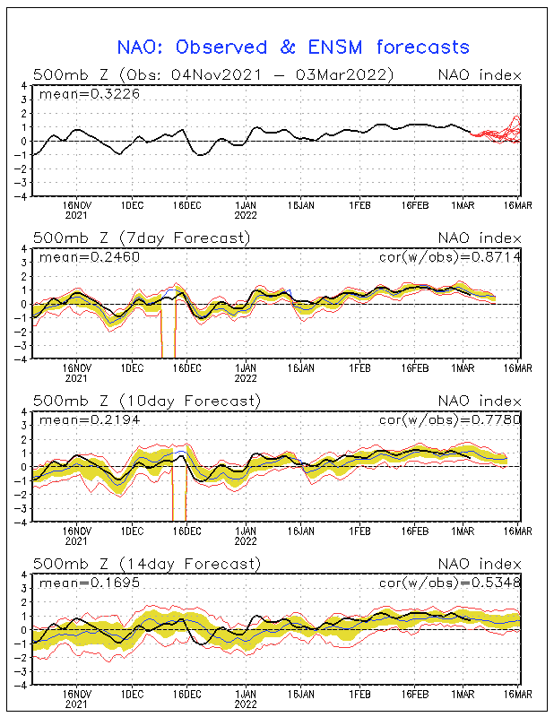
Now.. im not at all saying there is going to be another hurricane Katrina..Wilma and Rita in the gulf this year but I am saying the potential is there for some very strong Tropical cyclones to affect the gulf coast states! The NAO and AO both have been hanging out in neutral territory for a while now! During the 2005 hurricane season the NAO and AO both also stayed around neutral from June through OCT and current sea surface temps suggest the same NAO/AO phase will take place this season and here is the link to the sea surface temp anomaly

If the NAO/AO stay in a neutral phase then there will not likely be a mean (average) trough near the east coast of the US to whisk systems away off to the NE or out to sea like we have seen the past few years. In this type of pattern tropical systems/waves that form out in the central Atlantic will not have any place to go except westward towards the Bay of Campeche and the Gulf of Mexico area! If they get organized quickly at the lower latitudes they will be more likely to be gulf storms than BOC storms because intensifying tropical cyclones tend to head poleward as they strengthen.
The tropical cyclone heat potential in the lower latitudes (tropical cyclone genesis area) is already above normal! Here is the link to the tropical cyclone heat potential anomaly

This will mean that when the shear dies down later around July/August favorable conditions will form for rapidly organizing low latitude Tropical systems and they will try to head poleward but with the lack of a -NAO/AO pattern there will more than likely be some type of a "Bermuda block" that will prevent alot of recurves and east coast systems/landflalls for the most part.. and from a synoptic standpoint. So... when a tropical cyclone tries to go poleward it will be blocked from doing so and will have no choice but to head towards the Carribean and Gulf Of Mexico area.
In my opinion unless something changes pretty quickly I think we are looking at a very active season along the gulf coast. WXeastern is predicting 19 named storms with 3-6 being major (CAT 3 or above) with at least 4 US landfalls and possibly even more! Below is a graphical version of the outlook showing the highest threat areas and most likely tracks according to the data that was used to put this outlook together. Thanks for reading

Ok..lets get started! Ive never really been more bullish on a hurricane season forecast before and I have did several over the last few years. First of all many of the historically active seasons that had at least two major hurricane landfalls on the gulf coast have one thing in common! Alot of them had a named storm in the first half of the month of June which is really early to have a tropical cyclone. We've already had one form on June 5th... TS Andrea! The infamous 2005 season had its first tropical storm on June 8th which also never became a hurricane just like Andrea this year.
The super busy and destructive 2005 season also had a neutral like El Nino Southern Oscillation values (ENSO) that are very similar to expected ENSO values this season! Here is the link to computer predictions pof ENSO values

That means its not really an El nino or a La Nina but in between the two. By June 28 2005 another tropical cyclone had formed in the Bay Of Campeche making two named storms before the month of June 2005 was even over!
There is currently an invest area just to the SE of the Bay of Campeche that the National Hurricane center has highlighted and here is the link to that feature!

Several models have been developing this feature and taking it into the Bay of Campeche where it becomes a Tropical cyclone but that's still a ways out. The main thing to take away from this is the pattern that is currently in place is very similar to that of 2005 and will support numerous tropical cyclones with a favored Gulf Of Mexico track unless the pattern quickly and drastically changes. That is still possible but I dont think its likely to happen based on past analog and climatological data.
Now.. im not at all saying there is going to be another hurricane Katrina..Wilma and Rita in the gulf this year but I am saying the potential is there for some very strong Tropical cyclones to affect the gulf coast states! The NAO and AO both have been hanging out in neutral territory for a while now! During the 2005 hurricane season the NAO and AO both also stayed around neutral from June through OCT and current sea surface temps suggest the same NAO/AO phase will take place this season and here is the link to the sea surface temp anomaly

If the NAO/AO stay in a neutral phase then there will not likely be a mean (average) trough near the east coast of the US to whisk systems away off to the NE or out to sea like we have seen the past few years. In this type of pattern tropical systems/waves that form out in the central Atlantic will not have any place to go except westward towards the Bay of Campeche and the Gulf of Mexico area! If they get organized quickly at the lower latitudes they will be more likely to be gulf storms than BOC storms because intensifying tropical cyclones tend to head poleward as they strengthen.
The tropical cyclone heat potential in the lower latitudes (tropical cyclone genesis area) is already above normal! Here is the link to the tropical cyclone heat potential anomaly

This will mean that when the shear dies down later around July/August favorable conditions will form for rapidly organizing low latitude Tropical systems and they will try to head poleward but with the lack of a -NAO/AO pattern there will more than likely be some type of a "Bermuda block" that will prevent alot of recurves and east coast systems/landflalls for the most part.. and from a synoptic standpoint. So... when a tropical cyclone tries to go poleward it will be blocked from doing so and will have no choice but to head towards the Carribean and Gulf Of Mexico area.
In my opinion unless something changes pretty quickly I think we are looking at a very active season along the gulf coast. WXeastern is predicting 19 named storms with 3-6 being major (CAT 3 or above) with at least 4 US landfalls and possibly even more! Below is a graphical version of the outlook showing the highest threat areas and most likely tracks according to the data that was used to put this outlook together. Thanks for reading

 Re: WXeastern/Toots 2013 Hurricane season forecast
I don't know if there is any correlation or not, but I remember the winter of 2005/06 brought at least two 4" snows here in the valley.
Here is to hoping we have cold and wet winter starting later this year.
Here is to hoping we have cold and wet winter starting later this year.

 Similar topics
» Hurricane forecast for 2013: Look for an active season
» Frankies 2012 Hurricane season Forecast
» Toots Febuary thru March Forecast
» NOAA predicts a near-normal 2012 Atlantic hurricane season
» FSU predicts active hurricane season while others are predicting less active
» Frankies 2012 Hurricane season Forecast
» Toots Febuary thru March Forecast
» NOAA predicts a near-normal 2012 Atlantic hurricane season
» FSU predicts active hurricane season while others are predicting less active
Page 1 of 1
Permissions in this forum:
You cannot reply to topics in this forum

