The elusive post New Years 2013 storm system (Accumulating snow possible)
+17
Snowflake
SignalMtnTnVol
memoriesof85&93
Pman1618
snowman72
wxgeek
John1122
jeffmac99
Grandpa Nasty
tennessee storm09
VFL
etnwx
windstorm
Jscentraltn
Neals
Jed33
Toot
21 posters
Page 2 of 7
Page 2 of 7 •  1, 2, 3, 4, 5, 6, 7
 Re: The elusive post New Years 2013 storm system (Accumulating snow possible)
yeah the euro is starting to come around with this gulf low... and without any blocking in place during time frame... she will trend even further north... but i also dont like the looks of the low pressure going on same time parked near the great lakes area... THAT would cause us some serious waa issues, think MEG may be on to that. cause they r already saying looks like a cold rain for us west tn with this system per euro... and the suppressed look by the gfs is a good thing at this timeframe, typcial gfs... COLOR ME INTERESTED AFTER NEWYEARS DAY TIME FRAME.Toot wrote:As expected the latest run of the european model shifts the suppressed gulf low a little north! I expect more adjustments north will continue the next couple of runs putting northern AL and GA into the game! Pattern will support classic "Southern Slider" snow storm.
Here is the latest from the european. I expect this graphic to start showing snow further south into GA AL and possibly MS the next few runs.
tennessee storm09- Severe Wx Specialist
- Posts : 1304
Join date : 2011-12-05
Age : 61
Location : jackson,tennessee(home of 3 ef4 tornadoes since 1999)
 Re: The elusive post New Years 2013 storm system (Accumulating snow possible)
EDIT MY LAST POST AT TOP. i meant without hardly any blocking, she will trend even further north with time. LOL
tennessee storm09- Severe Wx Specialist
- Posts : 1304
Join date : 2011-12-05
Age : 61
Location : jackson,tennessee(home of 3 ef4 tornadoes since 1999)
 Re: The elusive post New Years 2013 storm system (Accumulating snow possible)
The NAM is still trying to get another wave of low pressure going along the Arctic boundary after this weekends gulf low exits. It has been very bullish and consistent with this idea so this will need to be watched!
This wave of low pressure is actually stuffed in between two other significant low pressure systems! The GFS doesnt really form this wave until its almost off the east coast but the GFS looks to be having major problems with its cold bias during the pattern change .
The Euro doesnt have it at all and teh Canadian is sort of in between the GFS and the NAM. Either way it doesnt look too significant via models but looks can be decieving!
This whole pattern change and struggling guidance models situation could make the forecasters job very rough during the next week as its possible that this all comes down to a nowcasting scenario! One of those where you wont know whats gonna happen until you see it coming on radar/satellite! Thats my favorite kind too..the kind that catches everybody off guard and sends people scrambling to catch up. Ok.. im rambling now..here's the Nam graphics


 Re: The elusive post New Years 2013 storm system (Accumulating snow possible)
tennessee storm09 wrote:EDIT MY LAST POST AT TOP. i meant without hardly any blocking, she will trend even further north with time. LOL
I fixed it for you bruce

Anyways..the post New Years system cant come too far north due to the piece of Polar vortex that will block it from doing so or will phase with it to create an all out snowstorm. The Euro is actually phasing the two pieces of energy together..the northern stream energy wraps up enough to pull the southern stream energy into it! While the GFS is using the Northern stream energy (PV) to push or squash the southern stream energy even further south.
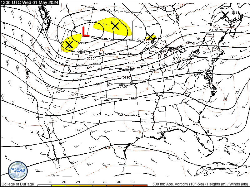
Here is the latest 500mb heights and vorticity loops from the euro and gfs. I made animated gifs just for us here on this weather forum of the two models so we can see how differently each are handling the energy.
0z euro phasing the post new years system

Latest GFS shunting the southern stream energy south and east off the coast

If you cant tell im pretty excited/pumped about the pattern but the graphics will probably go to the members only section from here on out! We need more participation from members here but there is alot of scummy critters that just lurk around here as guests to steal graphics.
They just grab them and go post them somewhere else like they payed for them or something! They do this without giving weatherbell or anyone else any credit.
So..from here on out you will have to be logged in to see potential snow storm graphics
 Re: The elusive post New Years 2013 storm system (Accumulating snow possible)
A few of the 12zGFS ensembles really crush Tennessee!! A couple of them are blockbuster phasing Miller A storms. This could be the start of the GFS trending towards the euro.
 Re: The elusive post New Years 2013 storm system (Accumulating snow possible)
a little off topic but we were supposed to hit 50 today with rain arriving around 5 this afternoon. Rain started at 12:30 and temp has dropped to 38* at my house. Rain and sleet pellets were hitting the Jeep on the way home from the beer store as well.
Edit to add: Temp has dropped to 35* with rain. I'm not sure this was expected. What about it Toot or any of you other Weather geeks? I figured the warm nose would jack up our temps.
Edit to add: Temp has dropped to 35* with rain. I'm not sure this was expected. What about it Toot or any of you other Weather geeks? I figured the warm nose would jack up our temps.

Grandpa Nasty- Banned
- Posts : 189
Join date : 2012-01-09
Location : Chattanooga, TN
 Re: The elusive post New Years 2013 storm system (Accumulating snow possible)
Temps on up above us in the atmosphere where it matters (850-925mb) are above freezing..temperatures will likely rise a few degrees at the surface but not much. Other words a nice cold rainGrandpa Nasty wrote:
Edit to add: Temp has dropped to 35* with rain. I'm not sure this was expected. What about it Toot or any of you other Weather geeks? I figured the warm nose would jack up our temps.
In other news..still no consistency with guidance models. The latest euro now looks worse than the GFS with the post new years storm...clipper that transfers energy off the east coast and turns into massive Nor'easter! We will need that phase in this situation to get significant snow here.
EDIT: The euro is still phasing but this run its just a little too late for us
 Re: The elusive post New Years 2013 storm system (Accumulating snow possible)
Looking at some of the past model runs of the euro and gfs. It looks like they are amplifying the trough more and shifting it further west. I still think the next couple runs we may start to see some consistency! I am hoping it has the storm phasing further west.

Jscentraltn- Admin
- Posts : 703
Join date : 2013-01-19
Age : 45
Location : Cheatham county
 Re: The elusive post New Years 2013 storm system (Accumulating snow possible)
Looked at the Canadian model it has the storm as well. One thing once whatever passes on Thursday. It is going to get very COLD!!!!!! We need phasing,phasing,phasing...... 


Jscentraltn- Admin
- Posts : 703
Join date : 2013-01-19
Age : 45
Location : Cheatham county
 Re: The elusive post New Years 2013 storm system (Accumulating snow possible)
DT must be drunk! He posted both of these posts about an hour from each other..LOL!!


 Re: The elusive post New Years 2013 storm system (Accumulating snow possible)
Apparently the second post was talking about the euro ensemble mean..lol
 Re: The elusive post New Years 2013 storm system (Accumulating snow possible)
Alright that's it! Can't look anymore I will pull my hair out. The model mash! I'am going to go  I will look late tonight or in the morning.
 I will look late tonight or in the morning.
Jscentraltn- Admin
- Posts : 703
Join date : 2013-01-19
Age : 45
Location : Cheatham county
 Re: The elusive post New Years 2013 storm system (Accumulating snow possible)
Looking at the 1800 GFS, I really don't see anything to get excited about. Maybe some lows in the teens next Saturday, but no snow event for E. TN except for flurries/dusting at best.
I'm learning to read the models, and I have a bunch more to learn, so don't think of me as a down caster. I'd love to see at least a 3+" event, but I can't see something that isn't there. If I'm missing something, let me know.
The 1200 ECMWF shows a possibility of light snow on Jan. 2nd, but probably we'd get a light dusting. The 1800 NAM show another minor dusting event on the 31st, but nothing on the 2nd.
Last edited by etnwx on 2013-12-28, 7:51 pm; edited 2 times in total (Reason for editing : Added what I see from the ECMWF and NAM.)
 Re: The elusive post New Years 2013 storm system (Accumulating snow possible)
This is my first time posting but I've been viewing the site for several months now. I thought I would add that MRX earlier today mentions snow showers in their long term discussion.
AREA FORECAST DISCUSSION
NATIONAL WEATHER SERVICE MORRISTOWN TN
314 PM EST SAT DEC 28 2013
.LONG TERM...(MONDAY NIGHT THROUGH SATURDAY)...THE TAIL END OF TRAILING SHORT WAVE COULD BRING A COUPLE SNOW SHOWERS TO THE HIGHER TERRAIN ALONG THE NORTH CAROLINA BORDER FOR A BRIEF TIME MONDAY NIGHT BUT COLD HIGH PRESSURE BUILDS IN FOR THE FIRST PART OF THE WORK WEEK SHUTTING DOWN ANY CHANCE FOR PRECIPITATION MONDAY THROUGH WEDNESDAY. HOWEVER...MODELS COMING INTO A LITTLE BETTER AGREEMENT WITH THE ARRIVAL OF ANOTHER UPPER TROUGH ON THURSDAY. THE SYSTEM`S SURFACE LOW DEVELOPS WELL SOUTH ACROSS THE GULF OF MEXICO AND SHIFTS NORTHEAST OFF THE SOUTHEAST ATLANTIC COAST BY FRIDAY MORNING. ENOUGH MOISTURE AND SUFFICIENTLY COLD AIR FOR THE POSSIBILITY OF A PERIOD OF SNOW SHOWERS ACROSS THE AREA...MAINLY THURSDAY NIGHT INTO FRIDAY MORNING BEFORE DRIER AIR SPILLS BACK INTO THE REGION. THE REMAINDER OF THE FORECAST PERIOD FROM FRIDAY AFTERNOON THROUGH SATURDAY NIGHT COULD BE DRY AND SEASONABLY COLD.
jeffmac99- Member
- Posts : 9
Join date : 2013-03-02
Location : West Knoxville
 Re: The elusive post New Years 2013 storm system (Accumulating snow possible)
You seem to be reading the models just fine..but it was just this morning that the euro showed significant snow as did the GFS yesterday. The trends today have not been good for any significant snow (Northern stream just too dominant per guidance) but this thread was created mainly for these different little bursts of light snow in mind. Of course.. im still rooting for the big phasing storm but its not looking good at the moment.etnwx wrote:I'm learning to read the models, and I have a bunch more to learn, so don't think of me as a down caster. I'd love to see at least a 3+" event, but I can't see something that isn't there. If I'm missing something, let me know.
Welcome Jeff..feel free to post your heart out! You will fit right in with us weather nerdsjeffmac99 wrote:This is my first time posting but I've been viewing the site for several months now. I thought I would add that MRX earlier today mentions snow showers in their long term discussion.

 Re: The elusive post New Years 2013 storm system (Accumulating snow possible)
Yes..I changed the name of the thread!! Guidance models showed something really nice and wintry for days and they have now completely backed off of that idea.
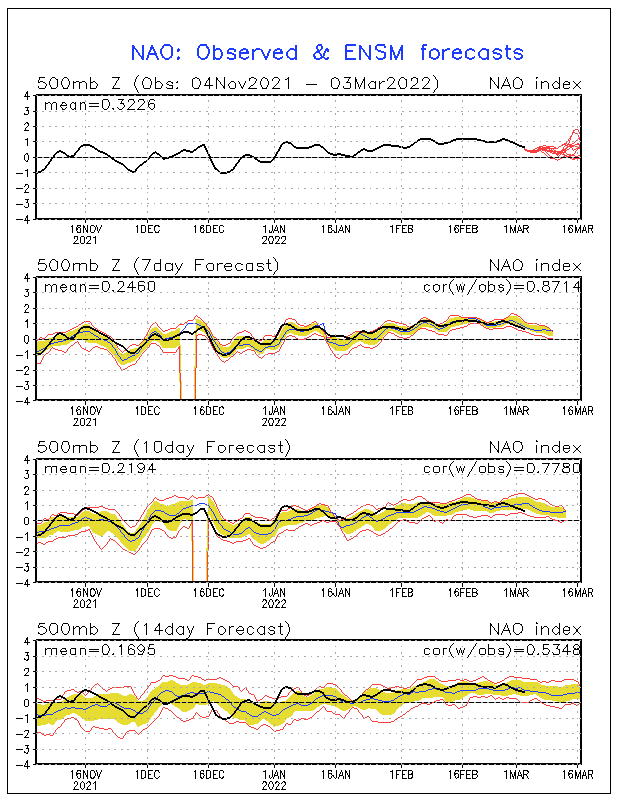
Another important lesson learned of why you almost ALWAYS have to have the NAO on your side to get significant snow here in TN! Even tho the AO is tanking it still doesnt add up without a -NAO! There may still be a couple of dustings in the lower elevations but even the lobe of the Polar Vortex doesnt look as strong as it once did.
I'll admit I bit down hard on this one only to get burned..lol
 Re: The elusive post New Years 2013 storm system (Accumulating snow possible)
man, i had to look twice... with my eyes stii havent focused from just got out of bed from sleep... thought is said BLIZZARD POTENTIAL... nothing to see here.. i am affraid this winter isnt going to produce either
tennessee storm09- Severe Wx Specialist
- Posts : 1304
Join date : 2011-12-05
Age : 61
Location : jackson,tennessee(home of 3 ef4 tornadoes since 1999)
 Re: The elusive post New Years 2013 storm system (Accumulating snow possible)
LOL..afraid this is aint gonna be no Blizzard! There is plenty of winter left tho.. no reason to give up on it its not going anywhere anytime soon.tennessee storm09 wrote:man, i had to look twice... with my eyes stii havent focused from just got out of bed from sleep... thought is said BLIZZARD POTENTIAL... nothing to see here.. i am affraid this winter isnt going to produce either
We just need to get the NAO into negative territory and everybodys attitude will change. I just wont be biting into anymore big snow threats in the east unless the NAO is also progged to go negative..no matter how nice of a snowstorm guidance shows

 Re: The elusive post New Years 2013 storm system (Accumulating snow possible)
Yeah! Last week when the NAO was predicted to go neg then a few days later showing more neautral. I started to doubt! But for fun since I can't copy and paste  . Look at the difference between the 84 hr gfs and the 84 nam 12z runs.

Jscentraltn- Admin
- Posts : 703
Join date : 2013-01-19
Age : 45
Location : Cheatham county
 Re: The elusive post New Years 2013 storm system (Accumulating snow possible)
if anything it looks to me its going even more positive as we go into januaryJscentraltn wrote:Yeah! Last week when the NAO was predicted to go neg then a few days later showing more neautral. I started to doubt! But for fun since I can't copy and paste. Look at the difference between the 84 hr gfs and the 84 nam 12z runs.
tennessee storm09- Severe Wx Specialist
- Posts : 1304
Join date : 2011-12-05
Age : 61
Location : jackson,tennessee(home of 3 ef4 tornadoes since 1999)
 Re: The elusive post New Years 2013 storm system (Accumulating snow possible)
GFS begin to show some signs of snow in Tenn, But the more runs that came out GFS begin to back away from the snow and has back off of the real cold air to. Watching models will break your heart at times. Now the cold air does not look as cold as it once did either.

windstorm- Member
- Posts : 891
Join date : 2012-03-26
Location : Harrison, tn
 Re: The elusive post New Years 2013 storm system (Accumulating snow possible)
I don't pay a lot of attention to the Euro models, maybe i should. But a lot of times the GFS may be out to lunch, lot of times it will come back down to earth. Not every time, but most likely within 2 to 3 days of what ever happens. Just my 2 cents worth.

windstorm- Member
- Posts : 891
Join date : 2012-03-26
Location : Harrison, tn
 Re: The elusive post New Years 2013 storm system (Accumulating snow possible)
I think the GFS op is still out in left field with the early January system! The Canadian Euro and GFS ensembles are in ok agreement with each other. They all have the Miller B like system and a decent looking upslope event to my eye for the mountains. It may even lay down a dusting or even an inch in the lower elevations of east TN north of I-40.
However.. the energy in question is still currently in a dead spot in the Arctic/North Pacific area where there are no weather balloons being launched into the atmosphere to take readings to sample this energy.
This means that there can still be significant changes to the track and strength of the storm system. The one hold out is the UKMET which is known for handling phasing between the northern and southern streams the best!
For the past few runs it has had bonified gulf low with a Miller A look to it but the odds of it being correct are very low when other guidance is taken into consideration. Yes..im still analyzing and scrutinizing model details with this system..its got ahold of me and wont let go..haha

 Re: The elusive post New Years 2013 storm system (Accumulating snow possible)
Weather and Tenn football go hand in hand. Lots of disappointment year after year.

VFL- Member
- Posts : 367
Join date : 2012-04-10
Age : 49
Location : North Knox County
 Re: The elusive post New Years 2013 storm system (Accumulating snow possible)
yep, you can also throw in the tennessee mens basketball team into that equation also... i miss bruce pearl. LOLVFL wrote:Weather and Tenn football go hand in hand. Lots of disappointment year after year.
tennessee storm09- Severe Wx Specialist
- Posts : 1304
Join date : 2011-12-05
Age : 61
Location : jackson,tennessee(home of 3 ef4 tornadoes since 1999)
Page 2 of 7 •  1, 2, 3, 4, 5, 6, 7
 Similar topics
» Accumulating snow possible (New Years timeframe)
» Accumulating Snow Possible Mar 24-26
» First accumulating snow possible Nov 13-16
» March 5-6th Winter Storm
» Post Christmas Storm
» Accumulating Snow Possible Mar 24-26
» First accumulating snow possible Nov 13-16
» March 5-6th Winter Storm
» Post Christmas Storm
Page 2 of 7
Permissions in this forum:
You cannot reply to topics in this forum

