Winter 2011/2012 Pattern Discussion
+19
Snowmania
jmundie
Vanster67
Homemommy
snowman72
Southeastbutter
snowdog
Mrgolf
jazzy
Math/Met
Jed33
Reb
Stovepipe
joereb1
tennessee storm09
John1122
skillsweather
Toot
Adam2014
23 posters
Page 6 of 37
Page 6 of 37 •  1 ... 5, 6, 7 ... 21 ... 37
 Re: Winter 2011/2012 Pattern Discussion
Cyclonicjunkie wrote:Good Morning...Im sure liking what im seeing on several models this morning. The GFS..CMC..NOGAPS and several of there ensembles are developing a gulf low on the tail end of the storm that comes through around the 20th. The storm around the 20th brings a powerful cold front thru the area and then cyclogenesis starts to take place along this cold front down near the gulf. This will set up a favorable storm track for the possibility of snow in several locales across the southeast and East Tennessee has the potential to be in the cold sector of the precip shield. Looks like models are starting to converge on a miller a type storm on Christmas Eve... it's about a week out at this point and there is plenty of time for good or bad trends...so this still should be taken lightly at this point but there has definately been some clarity supplied by the 0 and 6z run of the models this morning.
Awesome! Would be good to see the models latch onto this solution through the weekend so we can have a decent picture of what we're looking at. Like I said earlier, there is plenty of time for trends, and hopefully this was the trend that is going to happen.
Guest- Guest
 Re: Winter 2011/2012 Pattern Discussion
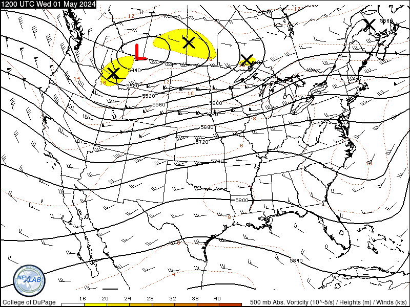
Also...looking at the current 500mb pattern across the northern hemisphere there are several favorable things jumping out at me this morning. Despite what the measured teleconnection indices are saying they are currently not matching up well with the actual upper air pattern.


 Re: Winter 2011/2012 Pattern Discussion
hopefully its a fairly strong cold front... cause that would or least help relax the ridge or even beat it down some... i havent check any models this morning... i am waiting on the 12z suites.Cyclonicjunkie wrote:Good Morning...Im sure liking what im seeing on several models this morning. The GFS..CMC..NOGAPS and several of there ensembles are developing a gulf low on the tail end of the storm that comes through around the 20th. The storm around the 20th brings a powerful cold front thru the area and then cyclogenesis starts to take place along this cold front down near the gulf. This will set up a favorable storm track for the possibility of snow in several locales across the southeast and East Tennessee has the potential to be in the cold sector of the precip shield. Looks like models are starting to converge on a miller a type storm on Christmas Eve... it's about a week out at this point and there is plenty of time for good or bad trends...so this still should be taken lightly at this point but there has definately been some clarity supplied by the 0 and 6z run of the models this morning.

tennessee storm09- Severe Wx Specialist
- Posts : 1304
Join date : 2011-12-05
Age : 61
Location : jackson,tennessee(home of 3 ef4 tornadoes since 1999)
 Re: Winter 2011/2012 Pattern Discussion
From what I saw this morning it looked like there was some cold air around chrstmas eve, but the precip wasn't quite where I'd like it to be.
Southeastbutter- Banned
- Posts : 33
Join date : 2011-12-14
 Re: Winter 2011/2012 Pattern Discussion
Southeastbutter wrote:From what I saw this morning it looked like there was some cold air around chrstmas eve, but the precip wasn't quite where I'd like it to be.
Ya..we need the low to be a little northwest and a little stronger...we will probably get the NW trend just from the underestimation of precip shields with gulf lows...they are ALWAYS underestimated....but if we can get the low to be a little deeper we will be in buisness nicely...still plenty of time for trends...from a synoptic standpoint I definately like the setup

EDIT: The 18z gfs holds the shortwave out in the southwest while the northern stream trough continues eastward and therefore there is no southern stream energy to phase with or produce a surface reflection. When it does finally kick the shortwave out there is no cold air from the northern stream....back to the confusing period of Christmas to New Years with several lps's that murk up the models accuracy...maybe this was just a burp in guidance and the 0z brings it back

 Re: Winter 2011/2012 Pattern Discussion
It seems I am talking to myself but Cosgrove is pretty much seeing the same thing I am with the Christmas timeframe
He also goes on to mention somewhat of a pattern change with the PNA becoming more positive resulting in more of a dominant western ridge and eastern troff....and I certainly agree with that....The PNA can deliver arctic air but without the negative NAO you will need southern stream energy to phase with northern stream energy to get a substancial snowstorm and this will be very possible with the active el nino like subtropical jet stream.
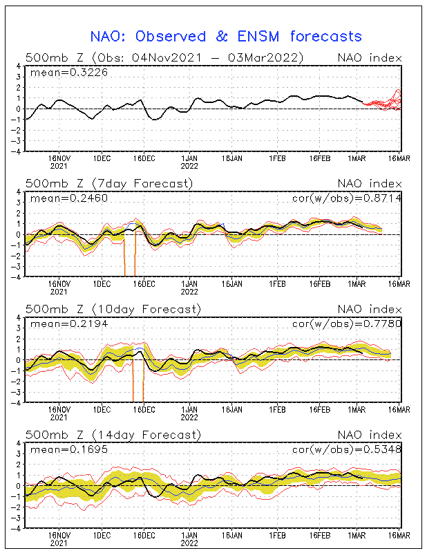
It seems that the AO and NAO will be heading down on the index as polar warming is starting to develop..but it remains to be seen if they will head into negative territory. With the 500mb pattern that I outlined in an earlier post (see above) it is not unlikely that will happen. We will have to wait and see...but we are certainly headed into a very active and cold period and climatology also backs this up. Excuse my excitement...I will now try to calm myself
The system which is now developing along the Pacific shoreline of California, and another taking shape southeast of Hawaii, will move in procession across the eastern two-thirds of the U.S. during the next week or so. With the 500MB ridge shifting into the Sargasso Sea, moisture from the Gulf of Mexico will be available to both disturbances. The second system may take a more southerly track (S TX into VA/MD/DE), so a change to sleet and snow is possible north of the disturbance in parts of the Corn Belt, Appalachia and the Northeast. While not a truly threatening set-up (at least yet; the potential for intensification is there....), it is not inconceivable that snow accumulations may crop up before Christmas Day in some localities. For many, however, the introduction to the holiday weekend will be a wet and chilly experience
He also goes on to mention somewhat of a pattern change with the PNA becoming more positive resulting in more of a dominant western ridge and eastern troff....and I certainly agree with that....The PNA can deliver arctic air but without the negative NAO you will need southern stream energy to phase with northern stream energy to get a substancial snowstorm and this will be very possible with the active el nino like subtropical jet stream.
It seems that the AO and NAO will be heading down on the index as polar warming is starting to develop..but it remains to be seen if they will head into negative territory. With the 500mb pattern that I outlined in an earlier post (see above) it is not unlikely that will happen. We will have to wait and see...but we are certainly headed into a very active and cold period and climatology also backs this up. Excuse my excitement...I will now try to calm myself

 Re: Winter 2011/2012 Pattern Discussion
uh oh toot's getting giddy!!!!

Reb- Admin
- Posts : 745
Join date : 2011-12-05
Location : Maryville, TN
 Re: Winter 2011/2012 Pattern Discussion
I am very excited about the recent changes and good news the models are showing (or are attempting to show). I think right now, the reason people aren't getting too excited about any of this is simply the fact of inconsistency over the past couple of weeks and that it is still too far out. I think Monday/Tuesday we will for sure know a lot more about what may happen around Christmas/the new year.
Southeastbutter- Banned
- Posts : 33
Join date : 2011-12-14
 Re: Winter 2011/2012 Pattern Discussion
Southeastbutter wrote:I am very excited about the recent changes and good news the models are showing (or are attempting to show). I think right now, the reason people aren't getting too excited about any of this is simply the fact of inconsistency over the past couple of weeks and that it is still too far out. I think Monday/Tuesday we will for sure know a lot more about what may happen around Christmas/the new year.
Exactly. I hardly ever believe the models even when they've been consistently correct for a while, so I definitely don't trust them at this juncture. I've been burnt too many times on that before where they show a pattern change but in reality it doesn't happen until like 2 weeks after its supposed to, if it does at all. I'm giving it some time before I get excited about any kind of a pattern change.
Guest- Guest
 Re: Winter 2011/2012 Pattern Discussion
How do I reply to someone else's comments?? Anyway... I have two things... If there was a storm for Christmas eve/Christmas right now that looked like a lock, I'd be waiting for it to let me down...2nd thing (excuse me if I speak incorrectly) The 06z (I believe this was for the 24th or 25th) showed the low pressure system about on the Florida panhandle and the 540 line was just entering west tn. The moisture was already all over us at that point. So, from that run it looked like the cold air was chasing the moisture and we didn't have anything cold locked in to make frozen precip. Is that a good possibility for a system like this??
Southeastbutter- Banned
- Posts : 33
Join date : 2011-12-14
 Re: Winter 2011/2012 Pattern Discussion
just click on the word that says quote, then type your post... nope, when you have cold chasing moisture, 9 out of 10 times not very good... i am not ready to jump on the xmas system just quite yet, let alone a pattern change... i just need to see some more positive signs, but that being said, hopefully were slowly going into the right direction.Southeastbutter wrote:How do I reply to someone else's comments?? Anyway... I have two things... If there was a storm for Christmas eve/Christmas right now that looked like a lock, I'd be waiting for it to let me down...2nd thing (excuse me if I speak incorrectly) The 06z (I believe this was for the 24th or 25th) showed the low pressure system about on the Florida panhandle and the 540 line was just entering west tn. The moisture was already all over us at that point. So, from that run it looked like the cold air was chasing the moisture and we didn't have anything cold locked in to make frozen precip. Is that a good possibility for a system like this??

tennessee storm09- Severe Wx Specialist
- Posts : 1304
Join date : 2011-12-05
Age : 61
Location : jackson,tennessee(home of 3 ef4 tornadoes since 1999)
 Re: Winter 2011/2012 Pattern Discussion
tennessee storm09 wrote:just click on the word that says quote, then type your post... nope, when you have cold chasing moisture, 9 out of 10 times not very good... i am not ready to jump on the xmas system just quite yet, let alone a pattern change... i just need to see some moreSoutheastbutter wrote:How do I reply to someone else's comments?? Anyway... I have two things... If there was a storm for Christmas eve/Christmas right now that looked like a lock, I'd be waiting for it to let me down...2nd thing (excuse me if I speak incorrectly) The 06z (I believe this was for the 24th or 25th) showed the low pressure system about on the Florida panhandle and the 540 line was just entering west tn. The moisture was already all over us at that point. So, from that run it looked like the cold air was chasing the moisture and we didn't have anything cold locked in to make frozen precip. Is that a good possibility for a system like this??positivenegative signs, but that being said, hopefully were slowly going into the right direction.
fixed it for you

Reb- Admin
- Posts : 745
Join date : 2011-12-05
Location : Maryville, TN
 Re: Winter 2011/2012 Pattern Discussion
Cyclo, what was cosgrove meaning when he was referring to the 500mb ridge shifting into the sargasso sea? How wood that effect us,if any? I do know that if we developed 500mb ridge over artic circle, i truly believe that wood help us out in the future. Definitely beats the pv there now. Also, if the pv could shift toward hudsons bay,instead over greenland,that wood more than likely alter the whole wx pattern for colder wx here. 

Mrgolf- Founding Member
- Posts : 53
Join date : 2011-12-06
 Re: Winter 2011/2012 Pattern Discussion
thanks rebtennessee storm09 wrote:just click on the word that says quote, then type your post... nope, when you have cold chasing moisture, 9 out of 10 times not very good... i am not ready to jump on the xmas system just quite yet, let alone a pattern change... i just need to see some more positive signs, but that being said, hopefully were slowly going into the right direction.Southeastbutter wrote:How do I reply to someone else's comments?? Anyway... I have two things... If there was a storm for Christmas eve/Christmas right now that looked like a lock, I'd be waiting for it to let me down...2nd thing (excuse me if I speak incorrectly) The 06z (I believe this was for the 24th or 25th) showed the low pressure system about on the Florida panhandle and the 540 line was just entering west tn. The moisture was already all over us at that point. So, from that run it looked like the cold air was chasing the moisture and we didn't have anything cold locked in to make frozen precip. Is that a good possibility for a system like this??

tennessee storm09- Severe Wx Specialist
- Posts : 1304
Join date : 2011-12-05
Age : 61
Location : jackson,tennessee(home of 3 ef4 tornadoes since 1999)
 Re: Winter 2011/2012 Pattern Discussion
I just ran through the entire 0z GFS and not once was there any snow on that run for my area. It looked terrible, I feel like I am just impatient. But I figure at least the GFS would show some snow in extended range. 


Adam2014- Founding Member
- Posts : 1424
Join date : 2011-12-05
Age : 28
Location : Lawrenceburg,TN
 Re: Winter 2011/2012 Pattern Discussion
adam, the only model that has showed us any love thus far has been the maple leaf model... gees we cant even get a fantasy storm on the gfs nor the euro... quite depressing.... cant even get excited for 6 hours at leastAdam2014 wrote:I just ran through the entire 0z GFS and not once was there any snow on that run for my area. It looked terrible, I feel like I am just impatient. But I figure at least the GFS would show some snow in extended range.

tennessee storm09- Severe Wx Specialist
- Posts : 1304
Join date : 2011-12-05
Age : 61
Location : jackson,tennessee(home of 3 ef4 tornadoes since 1999)
 Re: Winter 2011/2012 Pattern Discussion
I know, the GFS or the EURO show nothing at all. At least give us a fantasy storm...tennessee storm09 wrote:adam, the only model that has showed us any love thus far has been the maple leaf model... gees we cant even get a fantasy storm on the gfs nor the euro... quite depressing.... cant even get excited for 6 hours at leastAdam2014 wrote:I just ran through the entire 0z GFS and not once was there any snow on that run for my area. It looked terrible, I feel like I am just impatient. But I figure at least the GFS would show some snow in extended range.


Adam2014- Founding Member
- Posts : 1424
Join date : 2011-12-05
Age : 28
Location : Lawrenceburg,TN
 Re: Winter 2011/2012 Pattern Discussion
Mrgolf wrote:Cyclo, what was cosgrove meaning when he was referring to the 500mb ridge shifting into the sargasso sea? How wood that effect us,if any? I do know that if we developed 500mb ridge over artic circle, i truly believe that wood help us out in the future. Definitely beats the pv there now. Also, if the pv could shift toward hudsons bay,instead over greenland,that wood more than likely alter the whole wx pattern for colder wx here.
The sargasso sea is out in the Atlantic in the Bermuda area and eastward...He was talking about the intermittent southeast ridge at 500mb's shifting eastward....with the mean position of a PNA ridge/Eastern US trough and another ridge out in the Atlantic in the Sargasso sea...if you have a trough here in the eastern US most of the time you will have some type of Bermuda ridge or ridge in the Sargasso sea in direct response to that trough.
This is nothing bad though... as some people for some reason seem to relate any ridge in close proximity to the eastern U.S as not a conducive pattern for wintry weather. That is far from the truth...if you didnt have this ridge the flow would be more zonal like and and storms would shoot straight off into the Atlantic instead of turning NE and forming into Noreasters
Im just getting excited due to the pattern that I see developing from now on into New years and possibly beyond...this pattern will likely produce a snowstorm or two somewhere in the eastern U.S in the next two weeks. I thought the models had somewhat sorted this timeframe out but they are still having trouble as the gfs and its ensembles still cant decide if there will be two or three low pressure systems from now to a day or two after Christmas...alot of that depends on how strong the lakes cutter is in a couple of days.
The one thing that people should take away from what the models are showing is that the storm track seems to be shifting to a more favorable position. They have shown the mean track to shift to more of a southern slider/Gulf low/Miller-A position instead of the Apss runner/Lakes cutter stormtrack that has been so dominant this fall and early December. Also this mornings ensembles are now starting to show the PV feature that has been locked in over eastern Canada and Greenland to retrograde westward in the extended range...if that happens it will open up the door for intense Arctic outbreaks and height building in the NAO region

 Re: Winter 2011/2012 Pattern Discussion
The models are definately showing some inconsistancy; I would just like to see some more stuff in the long range.Cyclonicjunkie wrote:Mrgolf wrote:Cyclo, what was cosgrove meaning when he was referring to the 500mb ridge shifting into the sargasso sea? How wood that effect us,if any? I do know that if we developed 500mb ridge over artic circle, i truly believe that wood help us out in the future. Definitely beats the pv there now. Also, if the pv could shift toward hudsons bay,instead over greenland,that wood more than likely alter the whole wx pattern for colder wx here.
The sargasso sea is out in the Atlantic in the Bermuda area and eastward...He was talking about the intermittent southeast ridge at 500mb's shifting eastward....with the mean position of a PNA ridge/Eastern US trough and another ridge out in the Atlantic in the Sargasso sea...if you have a trough here in the eastern US most of the time you will have some type of Bermuda ridge or ridge in the Sargasso sea in direct response to that trough.
This is nothing bad though... as some people for some reason seem to relate any ridge in close proximity to the eastern U.S as not a conducive pattern for wintry weather. That is far from the truth...if you didnt have this ridge the flow would be more zonal like and and storms would shoot straight off into the Atlantic instead of turning NE and forming into Noreasters
Im just getting excited due to the pattern that I see developing from now on into New years and possibly beyond...this pattern will likely produce a snowstorm or two somewhere in the eastern U.S in the next two weeks. I thought the models had somewhat sorted this timeframe out but they are still having trouble as the gfs and its ensembles still cant decide if there will be two or three low pressure systems from now to a day or two after Christmas...alot of that depends on how strong the lakes cutter is in a couple of days.
The one thing that people should take away from what the models are showing is that the storm track seems to be shifting to a more favorable position. They have shown the mean track to shift to more of a southern slider/Gulf low/Miller-A position instead of the Apss runner/Lakes cutter stormtrack that has been so dominant this fall and early December. Also this mornings ensembles are now starting to show the PV feature that has been locked in over eastern Canada and Greenland to retrograde westward in the extended range...if that happens it will open up the door for intense Arctic outbreaks and height building in the NAO region

Adam2014- Founding Member
- Posts : 1424
Join date : 2011-12-05
Age : 28
Location : Lawrenceburg,TN
 Re: Winter 2011/2012 Pattern Discussion
man i wish were in the position this morning the panhandles of texas and okie and western kansas was starring at, sweet looking winter storm for those parts on the 12z gfs and nam..
tennessee storm09- Severe Wx Specialist
- Posts : 1304
Join date : 2011-12-05
Age : 61
Location : jackson,tennessee(home of 3 ef4 tornadoes since 1999)
 Re: Winter 2011/2012 Pattern Discussion
Did anyone else see something happening again on the gfs this morning for a storm on the 25th/26th? If so, was there cold temps in place? I was unable to look, but I find it hard to believe the models picked up on temps cold enough for snow. What I saw at one point last night was that the models had lost it completely for a moment. The flip flop is driving me crazy/also fun because at one minute we are all (by all I mean those people that take models too seriously this far out) are for sure winter is over, then all of a sudden... there is hope.. haha
Southeastbutter- Banned
- Posts : 33
Join date : 2011-12-14
 Re: Winter 2011/2012 Pattern Discussion
at least the storm is there, and on that run were getting closer to something big... just hope we have colder temps to work withSoutheastbutter wrote:Did anyone else see something happening again on the gfs this morning for a storm on the 25th/26th? If so, was there cold temps in place? I was unable to look, but I find it hard to believe the models picked up on temps cold enough for snow. What I saw at one point last night was that the models had lost it completely for a moment. The flip flop is driving me crazy/also fun because at one minute we are all (by all I mean those people that take models too seriously this far out) are for sure winter is over, then all of a sudden... there is hope.. haha
tennessee storm09- Severe Wx Specialist
- Posts : 1304
Join date : 2011-12-05
Age : 61
Location : jackson,tennessee(home of 3 ef4 tornadoes since 1999)
 Re: Winter 2011/2012 Pattern Discussion
Southeastbutter wrote:one minute we are all (by all I mean those people that take models too seriously this far out) are for sure winter is over, then all of a sudden... there is hope.. haha
This is also known as cliff diving

Its a winter tradition

 Re: Winter 2011/2012 Pattern Discussion
12z Euro trying really hard to throw us a bone around the 28th.
 Re: Winter 2011/2012 Pattern Discussion
Hey lets all help out and grab it and take whatever we can get to help us out of this lame pattern. No one handers use both your hands and your feet too if you can!
skillsweather- Banned
- Posts : 313
Join date : 2011-12-06
Age : 32
Location : tennessee Wilson county Ne Corner
Page 6 of 37 •  1 ... 5, 6, 7 ... 21 ... 37
 Similar topics
» Winter 2012/13 wx discussion
» Is winter over? Very weird pattern going on!!
» Winter wx Discussion 2015/16
» Winter Wx Discussion 2013/14
» Winter Wx Discussion 2014/2015
» Is winter over? Very weird pattern going on!!
» Winter wx Discussion 2015/16
» Winter Wx Discussion 2013/14
» Winter Wx Discussion 2014/2015
Page 6 of 37
Permissions in this forum:
You cannot reply to topics in this forum

