


Eastern US Winter Storm possible(Thanksgiving timeframe)
Page 3 of 6 •  1, 2, 3, 4, 5, 6
 ![]()
Re: Eastern US Winter Storm possible(Thanksgiving timeframe)
![]() by Toot 2012-11-12, 10:17 pm
by Toot 2012-11-12, 10:17 pm

This thread is just a possibility thread NOBODY IS CALLLING FOR SNOW RIGHT NOW..its just a possibility somewhere in the eastern US. I hope everybody understands what im talking about now

Last edited by Toot on 2012-11-12, 10:21 pm; edited 1 time in total

Toot- La Vida Loca
- Posts : 6644
Join date : 2011-12-05
Location : Cocke County, TN -

Re: Eastern US Winter Storm possible(Thanksgiving timeframe)
![]() by Adam2014 2012-11-12, 10:23 pm
by Adam2014 2012-11-12, 10:23 pm

Adam2014- Founding Member
- Posts : 1424
Join date : 2011-12-05
Age : 28
Location : Lawrenceburg,TN
Re: Eastern US Winter Storm possible(Thanksgiving timeframe)
![]() by Stovepipe 2012-11-12, 10:27 pm
by Stovepipe 2012-11-12, 10:27 pm
Adam2014 wrote:Stove look at the Euro at hours 150-180 and tell me that it does not exactly look like a Nor'Easter. I don't want to start an argument, but that storm right there has potential.
Adam, I've never said there was no potential. My beef is with Toot's megalomaniacal crazy pill posting.

Stovepipe- Founding Member
- Posts : 4148
Join date : 2011-12-05
Age : 48
Location : Knoxville, TN -
Re: Eastern US Winter Storm possible(Thanksgiving timeframe)
![]() by Adam2014 2012-11-12, 10:28 pm
by Adam2014 2012-11-12, 10:28 pm
Alright I was just making sure, and as a request to some of the bickering. Let us tone it down a little bit. No reason to get in an argument over a storm that hasn't even happened yet.Stovepipe wrote:Adam2014 wrote:Stove look at the Euro at hours 150-180 and tell me that it does not exactly look like a Nor'Easter. I don't want to start an argument, but that storm right there has potential.
Adam, I've never said there was no potential. My beef is with Toot's megalomaniacal crazy pill posting.
Adam2014- Founding Member
- Posts : 1424
Join date : 2011-12-05
Age : 28
Location : Lawrenceburg,TN
Re: Eastern US Winter Storm possible(Thanksgiving timeframe)
![]() by Jed33 2012-11-12, 10:59 pm
by Jed33 2012-11-12, 10:59 pm
Jed33- Admin
- Posts : 930
Join date : 2011-12-09
Location : Morristown, TN
Re: Eastern US Winter Storm possible(Thanksgiving timeframe)
![]() by Toot 2012-11-12, 11:00 pm
by Toot 2012-11-12, 11:00 pm
Here is the post that started the thread
Toot wrote:Welp folks..its that time of year again and the first truly winter storm is now showing up around Thanksgiving! The local Cold signal Oscillations are tanking negative around this timeframe and the GFS/Euro/CMC ensembles have also keyed in on this possibility!
Most of the individual ensembles have keyed in on a rather robust LPS over the southeastern US! You have heard me mention the winter of 2009/10 as one of the better analogs and this point it looks like the best analog due to the almost identical AO values of last month and October of 2009! It was about the same timeframe in 2009 (end of Nov when the NAO/AO started to tanks..and sure enough the current AO/NAO is also progged to tank towards the last of November!
Here are the graphics to support my post above!
Here is the AO forecast..notice many ensembles are tanking around Turkey day timeframe
The same tanking on the NAO forecast!
Euro ensemble mean..signaling gulf type low with nice blocking in the higher lats!
GFS ensemble mean signaling the same..notice the sexy blocking going on in the higher lattitudes
GFS OP signaling a Miller A
I realize its in la la land but it certainly is a good possibility due to all the individual guidance members agreeing on this. Thats almost unheard of at that long of a range!
Fun Times looks likely IMO!


At this point I still dont know what to expect..I do expect somewhere in the eastern US to end up surprised with some snow!
Now..this is just a possibility thread for somewhere in the eastern US it doesnt mean possible snow in TN. Although I would say the mountains may end up with some.
As for the whole argument that broke out..I will not tolerate someone trolling a busy wx thread.. even if that person is an Admin/Mod.
That rule applies to everyone!
Toot- La Vida Loca
- Posts : 6644
Join date : 2011-12-05
Location : Cocke County, TN -
Re: Eastern US Winter Storm possible(Thanksgiving timeframe)
![]() by Jed33 2012-11-12, 11:23 pm
by Jed33 2012-11-12, 11:23 pm
Jed33- Admin
- Posts : 930
Join date : 2011-12-09
Location : Morristown, TN
Re: Eastern US Winter Storm possible(Thanksgiving timeframe)
![]() by Toot 2012-11-12, 11:28 pm
by Toot 2012-11-12, 11:28 pm
Jed33 wrote:David Aldrich just went on record that just after Tgiving big arctic blast. He feels confident knoxville sees it's first snow by Dec. 7
I seen that Jed. I think he is correct too
Toot- La Vida Loca
- Posts : 6644
Join date : 2011-12-05
Location : Cocke County, TN -
Re: Eastern US Winter Storm possible(Thanksgiving timeframe)
![]() by Toot 2012-11-13, 12:26 am
by Toot 2012-11-13, 12:26 am
But there is another trough showing up around thanksgiving. Im not sure the models are handling two troughs that close together correctly. It may be a case where the models just end up with one trough around the 24th but who knows at this point. How this/these troughs phase with the polar jet will determine who gets the snow in the eastern US.

Toot- La Vida Loca
- Posts : 6644
Join date : 2011-12-05
Location : Cocke County, TN -
Re: Eastern US Winter Storm possible(Thanksgiving timeframe)
![]() by Toot 2012-11-13, 8:49 am
by Toot 2012-11-13, 8:49 am
The second one near the end of the month 27th-29th looks more promising to affect a bigger area. Of course still a long ways out but this timeframe still holds much potential and as always.. I will be monitoring it.
Toot- La Vida Loca
- Posts : 6644
Join date : 2011-12-05
Location : Cocke County, TN -
Re: Eastern US Winter Storm possible(Thanksgiving timeframe)
![]() by jmundie 2012-11-13, 1:48 pm
by jmundie 2012-11-13, 1:48 pm
Toot wrote:Its getting clearer that there are two seperate systems during the last week or so of November. The first Nor'easter type system (which I thought could be the big one) looks to be too far offshore to affect anyone but areas in the extreme NE.
The second one near the end of the month 27th-29th looks more promising to affect a bigger area. Of course still a long ways out but this timeframe still holds much potential and as always.. I will be monitoring it.
You mean the one that occurs once the alaskan trough flattens out a bit, allowing the jet to buckle a bit more in the eastern US?

jmundie- Winter Specialist
- Posts : 743
Join date : 2011-12-19
Re: Eastern US Winter Storm possible(Thanksgiving timeframe)
![]() by jmundie 2012-11-13, 1:53 pm
by jmundie 2012-11-13, 1:53 pm
Stovepipe wrote:Adam2014 wrote:Stove look at the Euro at hours 150-180 and tell me that it does not exactly look like a Nor'Easter. I don't want to start an argument, but that storm right there has potential.
Adam, I've never said there was no potential. My beef is with Toot's megalomaniacal crazy pill posting.
This is not new folks. Toot has always been this way. Just starting earlier this year. Last year, the negative NAO was always just around the corner.
I'm really interested in who is going to pay money to read a non degreed hobbiest wishcast the weather.
jmundie- Winter Specialist
- Posts : 743
Join date : 2011-12-19
Re: Eastern US Winter Storm possible(Thanksgiving timeframe)
![]() by skillsweather 2012-11-13, 2:38 pm
by skillsweather 2012-11-13, 2:38 pm
Toot wrote:
You must have missed the temps nearly twenty degrees below normal around 8-10 days from now in east TN
Now the temps are almost all way above average on that chart. Its wrong now though right?

And this was posted just yesterday.
skillsweather- Banned
- Posts : 313
Join date : 2011-12-06
Age : 32
Location : tennessee Wilson county Ne Corner
Re: Eastern US Winter Storm possible(Thanksgiving timeframe)
![]() by Toot 2012-11-13, 3:07 pm
by Toot 2012-11-13, 3:07 pm
Toot- La Vida Loca
- Posts : 6644
Join date : 2011-12-05
Location : Cocke County, TN -
Re: Eastern US Winter Storm possible(Thanksgiving timeframe)
![]() by Toot 2012-11-13, 3:11 pm
by Toot 2012-11-13, 3:11 pm
Toot- La Vida Loca
- Posts : 6644
Join date : 2011-12-05
Location : Cocke County, TN -
Re: Eastern US Winter Storm possible(Thanksgiving timeframe)
![]() by Eric 2012-11-13, 5:25 pm
by Eric 2012-11-13, 5:25 pm
Toot, I think the NE will be ground zero for another "n'oreaster" type of storm, but think it'll be mostly a rain/wind event until the polar front jet turns more north and south, as progged by the globals. If the PFJ stays where it is, those Yankees will be getting more water...something they don't need. As Mundie, Stove, and Snowdog mentioned, there doesn't appear to be much cold air to work with, and while some view it as a small-scale factor, one could infer the nature of the air at play by looking at the synoptic scale.
Eric- Severe Wx Specialist
- Posts : 100
Join date : 2012-02-19
Re: Eastern US Winter Storm possible(Thanksgiving timeframe)
![]() by Toot 2012-11-13, 6:35 pm
by Toot 2012-11-13, 6:35 pm
Toot- La Vida Loca
- Posts : 6644
Join date : 2011-12-05
Location : Cocke County, TN -
Re: Eastern US Winter Storm possible(Thanksgiving timeframe)
![]() by Toot 2012-11-13, 6:48 pm
by Toot 2012-11-13, 6:48 pm
jmundie wrote:
This is not new folks. Toot has always been this way. Just starting earlier this year. Last year, the negative NAO was always just around the corner.
I'm really interested in who is going to pay money to read a non degreed hobbiest wishcast the weather.
Normally I would delete this post because its clearly adds nothing to this thread and is nothimg more than pure trolling. Consider this your one and only warning this winter Jmundie!
I admitted defeat on my winter forecast last year several times..but yet you have brought my 2011/2012 winter forecast failure to light once again here in a thread that has nothing to do with the winter of last year! But you fail to mention the ones I got correct in 2009/10 and 2010/11! I also faired pretty well with this last summer of 2012 forecast! But go ahead and ignore those because you only seem to be here to cheerlead when my forecasts fail.
Im not sure why you are even hung up on me and my forecasts since you seem to think that im a total dumbass that dont know how to forecast. Let me ask you..where the hell are your forecasts??? Since you're so much better at it than me??
Toot- La Vida Loca
- Posts : 6644
Join date : 2011-12-05
Location : Cocke County, TN -
Re: Eastern US Winter Storm possible(Thanksgiving timeframe)
![]() by Toot 2012-11-13, 8:15 pm
by Toot 2012-11-13, 8:15 pm


Last edited by Toot on 2012-11-13, 9:37 pm; edited 1 time in total
Toot- La Vida Loca
- Posts : 6644
Join date : 2011-12-05
Location : Cocke County, TN -
Re: Eastern US Winter Storm possible(Thanksgiving timeframe)
![]() by Jed33 2012-11-13, 8:22 pm
by Jed33 2012-11-13, 8:22 pm
Jed33- Admin
- Posts : 930
Join date : 2011-12-09
Location : Morristown, TN
Re: Eastern US Winter Storm possible(Thanksgiving timeframe)
![]() by Toot 2012-11-13, 8:30 pm
by Toot 2012-11-13, 8:30 pm
For those that dont know.. A Kocin signal is when we have a negative NAO pattern and when it starts trending towards positive it highly correlates to a Nor'easter type of system that doesnt go out to sea and rides somewhere along the east coast as a significant to major snowstorm! FYI most Nor'easters begin as gulf type lows!
Toot- La Vida Loca
- Posts : 6644
Join date : 2011-12-05
Location : Cocke County, TN -
Re: Eastern US Winter Storm possible(Thanksgiving timeframe)
![]() by Toot 2012-11-13, 10:45 pm
by Toot 2012-11-13, 10:45 pm
NW flow event
Toot- La Vida Loca
- Posts : 6644
Join date : 2011-12-05
Location : Cocke County, TN -
Re: Eastern US Winter Storm possible(Thanksgiving timeframe)
![]() by joereb1 2012-11-14, 12:40 am
by joereb1 2012-11-14, 12:40 am

joereb1- Banned
- Posts : 76
Join date : 2011-12-06
Location : Corryton, TN.
Re: Eastern US Winter Storm possible(Thanksgiving timeframe)
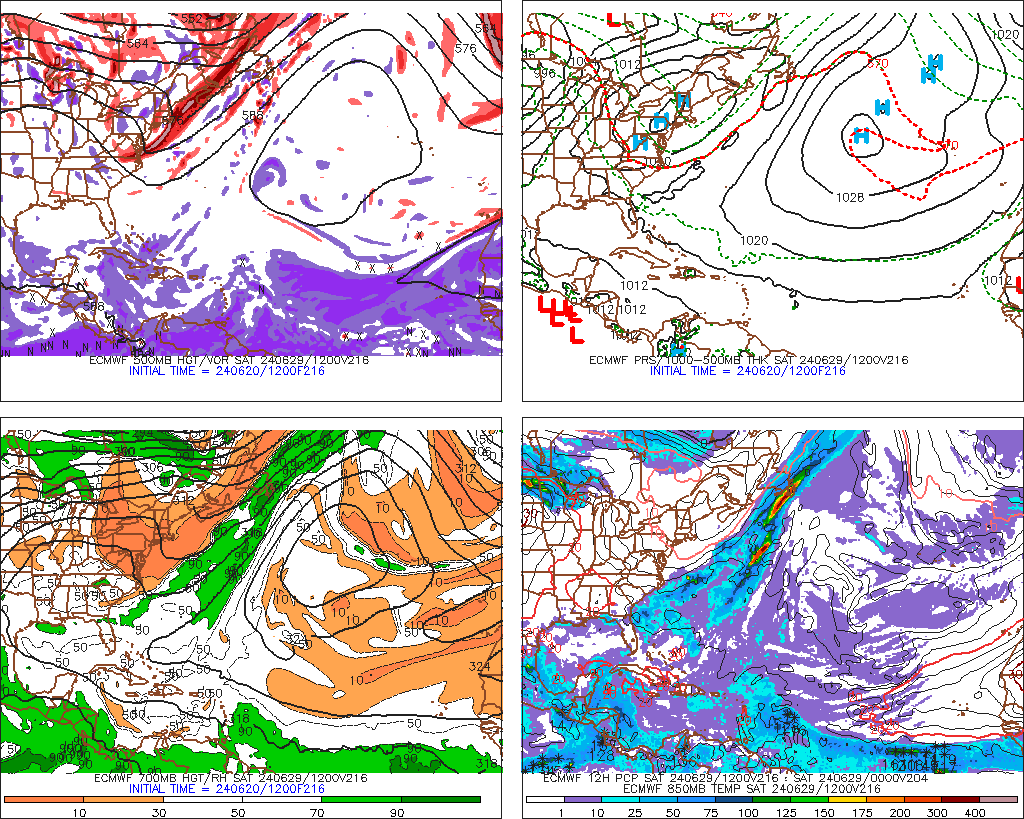
![]() by Toot 2012-11-14, 10:17 pm
by Toot 2012-11-14, 10:17 pm
Jed33 wrote:Definitely worth watching this threat. I haven't seen the 18z GFS, but apparently, according to Americanwx, the model develops dual blocking!!! splits the PV and displaces it pretty far South. Granted, its 18z, and its just one run, but it gives me encouragement that things may pick up soon here, like we've been talking about.
I have a higher than Normal confidence of a major snowstorm near the 27-29th. Impossible to say where in the eastern US this will affect but I have now officially raised by odds to 80% from 60% for this threads timeframe. I fully expect a Powerful snowstorm somewhere in the eastern US towards the end of the month!
Toot- La Vida Loca
- Posts : 6644
Join date : 2011-12-05
Location : Cocke County, TN -
Re: Eastern US Winter Storm possible(Thanksgiving timeframe)
![]() by tennessee storm09 2012-11-14, 10:21 pm
by tennessee storm09 2012-11-14, 10:21 pm
tennessee storm09- Severe Wx Specialist
- Posts : 1304
Join date : 2011-12-05
Age : 61
Location : jackson,tennessee(home of 3 ef4 tornadoes since 1999)
Page 3 of 6 • 1, 2, 3, 4, 5, 6 ![]()
» Winter Storm Tracks
» March 5-6th Winter Storm
» Over Running Winter storm Dec 6-8
» Jan 23-25 Winter storm (2015)


