Post Christmas Storm
+21
joereb1
VFL
Jed33
Coach B
Grandpa Nasty
keithinala
Eric
kailynleto
andyhb
Mrgolf
Reb
Snowflake
1234snow
tennessee storm09
Adam2014
skillsweather
Dyersburg Weather
snowdog
John1122
Clarksville Snowman
Toot
25 posters
Page 4 of 7
Page 4 of 7 •  1, 2, 3, 4, 5, 6, 7
 Re: Post Christmas Storm
Clarksville Snowman wrote:Toot, what are the euro ensembles looking like for the most part.
The 0zeuro ensembles havent finished running yet but the 12z euro ensembles were a little east of the operational euro. This is starting to get into the NAM/SREF range so we will have that to help out with track also.
 Re: Post Christmas Storm
Memphis NWS is all in, calling for 4-8 North of 40. 3-6 along 40. And even 1-3 in N. Miss.
I expect the rest of the state to have somewhere between flakes flying to an inch or so in the areas below 2000-2500 feet.
I expect the rest of the state to have somewhere between flakes flying to an inch or so in the areas below 2000-2500 feet.
John1122- Winter Specialist
- Posts : 885
Join date : 2011-12-06
Location : Campbell Co
 Re: Post Christmas Storm
If this western trend dont stop im not sure anyone in the state sees much at all. The NAM GFS and EURO all went west in their latest runs. 12z NAM currently running now
 Re: Post Christmas Storm
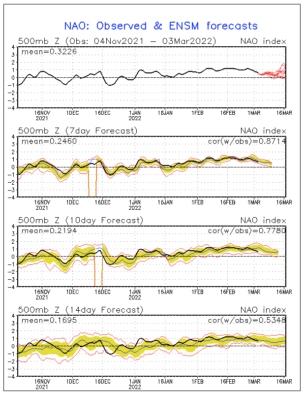
Blocking has been poorly modeled with this system as it once was being advertised as a strong west based NAO block. Its no longer being modeled as an NAO block. The block has gotten so far west that it has left the NAO region and no doubt will be PART of the reason this system will cut west of the Apps.
Its not impossible.. but its hard to get a decent snow here in TN without a good -NAO block. Jimmy (1234snow) mentioned the drop in confluence which is another reason this one is cutting. All this allows the trough/ULL to take on a more negative tilt before it gets far enough east to be good for us
Its not impossible.. but its hard to get a decent snow here in TN without a good -NAO block. Jimmy (1234snow) mentioned the drop in confluence which is another reason this one is cutting. All this allows the trough/ULL to take on a more negative tilt before it gets far enough east to be good for us

 Re: Post Christmas Storm
if the western trend doesnt stop, heck may have too turn ouur focus on some severe weather threat, especially areas along the tenn alabama border, extreme se tenn... this is getting interesting. had a bonafide chance too get a good snow this morning, with winter storm watches knocking on my door... to perhaps a lot of rain to outside shot at severe... what a turn a round. WOWToot wrote:If this western trend dont stop im not sure anyone in the state sees much at all. The NAM GFS and EURO all went west in their latest runs. 12z NAM currently running now
tennessee storm09- Severe Wx Specialist
- Posts : 1304
Join date : 2011-12-05
Age : 61
Location : jackson,tennessee(home of 3 ef4 tornadoes since 1999)
 Re: Post Christmas Storm
The 12z GFS is the first run I have seen with a believable transfer to the coast as the low jumps to the coast instead of another low magically reforming..so its a much more believable and trusted run. The 12z GFS and CMC are now in good agreement with the low tracking right over top of the Nashvegas area. I think light accumulations north of I-40 statewide can be expected from NW flow with a few inches of synoptic snow in western TN. I wouldnt be surprised to see the Dyersburg area get 4+ inches and that is being conservative. Of course all this is based on guidance being settled in on this solution and no more trends west or east.
We'll see what the doctor says now!
We'll see what the doctor says now!

 Re: Post Christmas Storm
the nam takes the winter weather out of western kentucy even... not liking what i am seeiing with lates trends... but nam hasnt been its best lately
tennessee storm09- Severe Wx Specialist
- Posts : 1304
Join date : 2011-12-05
Age : 61
Location : jackson,tennessee(home of 3 ef4 tornadoes since 1999)
 Re: Post Christmas Storm
While we may not get anything of significants here in middle tn, I don't think the NAM is right IMHO. I still think west tn and e ark,se mo are still in the game. But the jury is still out and nothing is set in stone. 

Clarksville Snowman- Member
- Posts : 35
Join date : 2012-12-14
 Re: Post Christmas Storm
Here is my final call on this system
A strong low pressure system will develop in the southern plains and track NE across the TN valley with strong winds and moderate to heavy snow in western parts of the region and along the higher elevations. The snow in the western parts of the region will be of the synoptic type while the higher amounts in elevated areas will be due to upslope flow. Lighter amounts will be possible along and north of I-40 as the system starts to advect colder air into the region and pull away to the NE. Hopefully this is just one of many winter cyclones to affect the region this season

It should be noted that the 2" part of the T-2" area is reserved for the higher elevations of the Plateau in KY/TN
A strong low pressure system will develop in the southern plains and track NE across the TN valley with strong winds and moderate to heavy snow in western parts of the region and along the higher elevations. The snow in the western parts of the region will be of the synoptic type while the higher amounts in elevated areas will be due to upslope flow. Lighter amounts will be possible along and north of I-40 as the system starts to advect colder air into the region and pull away to the NE. Hopefully this is just one of many winter cyclones to affect the region this season


It should be noted that the 2" part of the T-2" area is reserved for the higher elevations of the Plateau in KY/TN
Last edited by Toot on 2012-12-23, 7:41 pm; edited 1 time in total
 Re: Post Christmas Storm
Thanks for being generous to my location toot. I would love a big snow but if we pick up 2" the way it looks at the moment I would be elated. Having said that despite our lack of winters the last 25 years I do think that our winters in general are going to come back to earlier times in years to come. And also we live in a neck of the woods that can bring surprises and heartbreaks, it sure would be nice to get a surprise!! 


Clarksville Snowman- Member
- Posts : 35
Join date : 2012-12-14
 Re: Post Christmas Storm
Despite the negativity you are hearing on other forums its actually looking pretty decent for nice little snowfall in western parts of the state Clarksville. Guidance totally supports a decent snowfall in your neck of the woods.
HPC probs of snowfall greater than one inch

NWS

MEG

HPC probs of snowfall greater than one inch

NWS

MEG

 Re: Post Christmas Storm
Damn. Look at the significant tornado index. It extends well up in Tennessee. Snow and tornadoes ??


Dyersburg Weather- Banned
- Posts : 342
Join date : 2011-12-25
Age : 55
Location : Dyersburg , TN
 Re: Post Christmas Storm
Dyersburg Weather wrote:Damn. Look at the significant tornado index. It extends well up in Tennessee. Snow and tornadoes ??
Yuck...I hate the STP. It gets thrown around *way* too much and can be a bit misleading. Since the solution is algorithmic in nature, the results can be swayed either way given the value of the different parameters - CAPE and SRH. For example, if the CAPE values were large and the SRH values were small, that would give you a high STP...or vice-versa...if the SRH is high and the CAPE values are small.
OTOH, it nailed the April 27 event, so I guess that's why it's thrown around as much as it is, but it doesn't do anybody any good unless it's put in the proper context.
Eric- Severe Wx Specialist
- Posts : 100
Join date : 2012-02-19
 Re: Post Christmas Storm
4km NAM time
First the severe aspects
Moderate risk issued for parts of Dixieland

Just peaking at some hi res models there appears to be quite the wind threat if some of this can be mixed down to the surface


Then when the cold front pushes thru cold advection snow showers/squalls overtakes the state

Pretty impressive cold advection snows there if thats correct
First the severe aspects
Moderate risk issued for parts of Dixieland

Just peaking at some hi res models there appears to be quite the wind threat if some of this can be mixed down to the surface


Then when the cold front pushes thru cold advection snow showers/squalls overtakes the state

Pretty impressive cold advection snows there if thats correct
Last edited by Toot on 2012-12-24, 9:22 am; edited 1 time in total
 Re: Post Christmas Storm
Nice graphics toot.... The computer models are really starting to pick up on snow showers around the area. I like the look.

Adam2014- Founding Member
- Posts : 1424
Join date : 2011-12-05
Age : 28
Location : Lawrenceburg,TN
 Re: Post Christmas Storm
Seen where someone said the storm seems to be digging further south out west than anticipated. Any thoughts on this and what the impact for western half of tn and west ky. 

Clarksville Snowman- Member
- Posts : 35
Join date : 2012-12-14
 Re: Post Christmas Storm
The latest run of the GFS and its ensembles have trended wetter with the precip behind the front north of I-40. This will need to be watched to see if this is a new development


 Re: Post Christmas Storm
GFS sure is warm though, and the NAM is not as robust as the GFS. The NAM is around 48 hours too. We will see, but I just want to see some flakes flying around.

Adam2014- Founding Member
- Posts : 1424
Join date : 2011-12-05
Age : 28
Location : Lawrenceburg,TN
 Re: Post Christmas Storm
12z Canadian hammering western TN

It goes on to snow on the whole state but much lighter of course

It goes on to snow on the whole state but much lighter of course
 Re: Post Christmas Storm
Notice all the ensembles also picking up on the deeper moisture north of I-40 after the cold front pushes through. This would be due to upper level enhancement. If this trend holds and continues areas north of I-40 (even unelevated areas) may end up seeing a couple of inches.
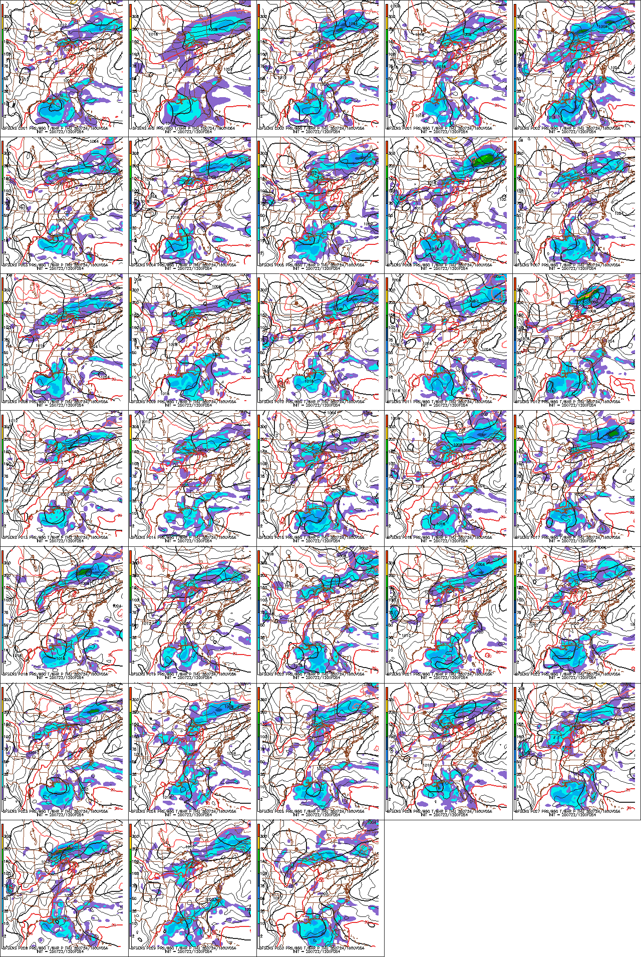
This has definately got my attention now

This has definately got my attention now
 Re: Post Christmas Storm
great point too, just fixing to point that out bud.Toot wrote:12z EURO in lock step agreement with the canadian and nails western TN
tennessee storm09- Severe Wx Specialist
- Posts : 1304
Join date : 2011-12-05
Age : 61
Location : jackson,tennessee(home of 3 ef4 tornadoes since 1999)
 Re: Post Christmas Storm
Models now coming in and moving this back East. These models have been atrocious, and at this rate middle tennessee will really be back in the game. Toot why wouldn't the models handle this storm well? Out for lunch?

Adam2014- Founding Member
- Posts : 1424
Join date : 2011-12-05
Age : 28
Location : Lawrenceburg,TN
 Re: Post Christmas Storm
Adam2014 wrote: Toot why wouldn't the models handle this storm well? Out for lunch?
Very active pattern means more energy for guidance products to deal with over a smaller area. The energy is now being sampled better too and models are now beginning to fine tune the track because of this. I imagine MEG will have to put more counties under winter wx products before the nights out. Gonna be a fun one over the whole state but much more fun in western TN
Meanwhile checkout the awesome new radar from PSU
http://www.meteo.psu.edu/~fxg1/WXTYPE/loop25se.html
Page 4 of 7 •  1, 2, 3, 4, 5, 6, 7
 Similar topics
» The elusive post New Years 2013 storm system (Accumulating snow possible)
» White Christmas 2012
» BIG DOG winter storm JAN 22-24
» White Christmas Chances higher than normal this year
» March 5-6th Winter Storm
» White Christmas 2012
» BIG DOG winter storm JAN 22-24
» White Christmas Chances higher than normal this year
» March 5-6th Winter Storm
Page 4 of 7
Permissions in this forum:
You cannot reply to topics in this forum

