Early FEB snow threat
+14
Reb
Grandpa Nasty
Southeastbutter
Homemommy
Adam2014
jmundie
skillsweather
John1122
ballpark
Snowmania
tennessee storm09
Stovepipe
snowman72
Toot
18 posters
Page 8 of 12
Page 8 of 12 •  1, 2, 3 ... 7, 8, 9, 10, 11, 12
 Re: Early FEB snow threat
Here's a post I made the other day on another forum, when this weirdly tilted trough started showing up on the euro. and then a new post from today.
[quote author=jmundie link=topic=2980.msg148392#msg148392 date=1327673529]
Well dang it, no sooner do I jump off the cliff than something interesting starts showing up. Of course.
My hope is that the euro is showing a piece of the pv breaking off over the southeast, like a big cut off low. This would likely yield some significant snow over the southeast, with temps staying below normal for some time... and hopefully (and this is pure hope) having that cut off would slow or stop the stream of energy from pounding greenland, destroying our chances of a block developing there. Best case scenario, we get this piece of the PV to break off, which keeps a western ridge, and then allows a ridge to build over greenland, and more cold to start dumping into the east from Canada. That is our best bet for an awesome february at this point.
But the way this winter has gone, the models will completely lose this feature either this afternoon or at 0z tonight.
[/quote]
BTW - 6z gfs found the cut off, and the euro is finding it too


Canadian has slightly different timing, so there isn't enough cold air there, but the energy is wanting to close off

The CMC ends up here at 240

and the Euro here

I really like the look of the Euro at 240. Nice ridge in the west, with a cut off underneath, which should send a steady stream of energy in the southern stream. Gonna be a long week, but I think we'll be tracking the system next weekend, and imagine more stuff will pop up in the long range beyond that as well.
[quote author=jmundie link=topic=2980.msg148392#msg148392 date=1327673529]
Well dang it, no sooner do I jump off the cliff than something interesting starts showing up. Of course.
My hope is that the euro is showing a piece of the pv breaking off over the southeast, like a big cut off low. This would likely yield some significant snow over the southeast, with temps staying below normal for some time... and hopefully (and this is pure hope) having that cut off would slow or stop the stream of energy from pounding greenland, destroying our chances of a block developing there. Best case scenario, we get this piece of the PV to break off, which keeps a western ridge, and then allows a ridge to build over greenland, and more cold to start dumping into the east from Canada. That is our best bet for an awesome february at this point.
But the way this winter has gone, the models will completely lose this feature either this afternoon or at 0z tonight.
[/quote]
BTW - 6z gfs found the cut off, and the euro is finding it too


Canadian has slightly different timing, so there isn't enough cold air there, but the energy is wanting to close off

The CMC ends up here at 240

and the Euro here

I really like the look of the Euro at 240. Nice ridge in the west, with a cut off underneath, which should send a steady stream of energy in the southern stream. Gonna be a long week, but I think we'll be tracking the system next weekend, and imagine more stuff will pop up in the long range beyond that as well.
Last edited by jmundie on 2012-01-28, 8:53 am; edited 1 time in total (Reason for editing : image link repair)
jmundie- Winter Specialist
- Posts : 743
Join date : 2011-12-19
 Re: Early FEB snow threat
Great description Jmundie, always appreciate your word here.

Adam2014- Founding Member
- Posts : 1424
Join date : 2011-12-05
Age : 28
Location : Lawrenceburg,TN
 Re: Early FEB snow threat
jmundie wrote:6z says cutoff low jackpot next weekend for Tennessee. Paint 3-6 inches for middle and east. With cold following.
Euro and CMC have a similar look.
Dont you do it Mundie. Dont you get your hopes up again.
snowdog- Winter Specialist
- Posts : 855
Join date : 2011-12-14
Age : 46
Location : Mount Juliet, TN
 Re: Early FEB snow threat
Trying so hard not too. This is the best run of models we've had this year for showing a storm or potential of a storm.
What worries me is that this will look good for several more days then disappear.
What worries me is that this will look good for several more days then disappear.
jmundie- Winter Specialist
- Posts : 743
Join date : 2011-12-19
 Re: Early FEB snow threat
Pro forecaster Brandon Huffman
if the euro is right it's going to be a fun february. the PNA spike is finally kicking the PV out of alaska and allowing the NA pattern to shift pretty dramatically.
Just checked out the 12z gfs ensembles and for the first time all winter I got excited about a wx model... Unreal +PNA through the entire run. Probably the highest PNA signal since 02/03. Unreal look. It's rare to see it show up that consistently and dramatically on the ensembles. That pattern would undoubtably produce multiple opportunites through february.
 Re: Early FEB snow threat
So first shot at snow is next weekend, then a fun February?! Can't wait
connerconner- Banned
- Posts : 46
Join date : 2012-01-12
 Re: Early FEB snow threat
after looking at the 0zgfs tonight,after some light snow showers next weekend... run not so hot in the longer range... seems like everytime we take a step forward, we take two steps back... just not ready to bite on a big change yet... still lackiing blocking on that run.
tennessee storm09- Severe Wx Specialist
- Posts : 1304
Join date : 2011-12-05
Age : 61
Location : jackson,tennessee(home of 3 ef4 tornadoes since 1999)
 Re: Early FEB snow threat
 Yea, some snowfall poss-O-bilities in the next 10 day period??

Vanster67- Admin
- Posts : 629
Join date : 2011-12-08
Age : 57
Location : Monterey, TN
 Re: Early FEB snow threat
I hope this football doesn't get pulled before we can kick it...
disco
my forecast
disco
FOR THURSDAY THROUGH SATURDAY...A GREAT DEAL OF MODELS DIFFERENCE IS
NOTED WITH TIMING OF ADDITIONAL SHORT-WAVE DIVING ACROSS THE PLAINS
STATES TOWARD THE OHIO/TENNESSEE VALLEYS. TIMING OF THESE WAVES IS
ALL OVER THE PLACE MAKING FORECAST OF BEST CHANCE OF PRECIPITATION
DIFFICULT WITH LOW CONFIDENCE. HOWEVER...ALL MODELS SHOW A PATTER
CHANGE BY NEXT WEEK WITH A LARGE SCALE UPPER TROUGH OVER THE EASTERN
HALF OF THE NATION WITH MUCH COLDER AIR SPILLING INTO THE SOUTHERN
APPALACHIANS. HAVE UNDER-CUT GUIDANCE TEMPERATURES FOR LATE IN THE
PERIOD...BUT COULD BE EVEN COLDER IF MODELS VERIFY.
ALSO...TIMING OF INDIVIDUAL WAVES DIVING INTO LONG-WAVE TROUGH COULD
SET THE STAGE FOR SNOW...ESPECIALLY FOR THE MOUNTAINS...NEXT WEEKEND.
&&
my forecast
Thursday Night: A slight chance of rain and snow showers. Mostly cloudy, with a low around 33. Chance of precipitation is 20%.
Friday: A chance of rain and snow showers. Partly sunny, with a high near 50. Chance of precipitation is 30%.
Friday Night: A chance of rain and snow showers. Mostly cloudy, with a low around 31. Chance of precipitation is 30%.
Saturday: A 30 percent chance of snow showers. Partly sunny, with a high near 36.
John1122- Winter Specialist
- Posts : 885
Join date : 2011-12-06
Location : Campbell Co
 Re: Early FEB snow threat
yes.. Lucy, Let Charlie B. kick the football this time. I am hoping that the temps are a little colder also. When would it be safe to say that the models might have a good enough grip on the details to start letting the excitement come on?

Vanster67- Admin
- Posts : 629
Join date : 2011-12-08
Age : 57
Location : Monterey, TN
 Re: Early FEB snow threat
My goodness at the euro 
It begins snowing next weekend and continues to snow on us for several days...pretty cold too.

It begins snowing next weekend and continues to snow on us for several days...pretty cold too.

 Re: Early FEB snow threat
Toot wrote:My goodness at the euro
It begins snowing next weekend and continues to snow on us for several days...pretty cold too.
It'll be gone by 12z lol
Guest- Guest
 Re: Early FEB snow threat
Yeah - Euro is perfect set up. If that pattern locks in, its going to be a long February. Huge PNA ridge, with energy under cutting it, -nao locking in the pv sitting just north of the lakes.
Holy crap is all one can say looking at 240. I hate to extrapolate, but I will tell you I'd love to see the next few frames.

Holy crap is all one can say looking at 240. I hate to extrapolate, but I will tell you I'd love to see the next few frames.

jmundie- Winter Specialist
- Posts : 743
Join date : 2011-12-19
 Re: Early FEB snow threat
Gonna be a fun, but probably frustrating, week of model watching. Best potential we've had all season. Glad have the Doc on board.


 Re: Early FEB snow threat
Stovepipe wrote:Gonna be a fun, but probably frustrating, week of model watching. Best potential we've had all season. Glad have the Doc on board.

Yeah - we cya only don't have a solution nailed down. Will likely be 48 hours until that happens. But the gfs has been worse than the Canadian in the 5 and 6 day verification. I think it's euro, ukie, CMC, gfs.
jmundie- Winter Specialist
- Posts : 743
Join date : 2011-12-19
 Re: Early FEB snow threat
It's gone be a nice warm up this week anyway. Lets hope we can enough cold air in here next weekend for a winter storm.
 Re: Early FEB snow threat
Such a large trough with a huge ridge out west, hopefully it holds.

Adam2014- Founding Member
- Posts : 1424
Join date : 2011-12-05
Age : 28
Location : Lawrenceburg,TN
 Re: Early FEB snow threat
Adam2014 wrote:Such a large trough with a huge ridge out west, hopefully it holds.

 Re: Early FEB snow threat
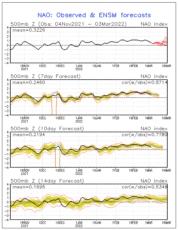
The gfs ensembles are still undecided on any kind of stormtrack...how the big PNA ridge gets orientated will have everything to do with the track of the upper level energy diving down out of Canada and that will decide what type of LPS (if any) we get at the surface. Im pretty excited with whats being modeled...but I would like to see more of a blocking anomaly show up in the NAO region to go with the other one.
12z euro is in and its a Miller B type system...verbatim its rain changing to snow with a very healthy NNW flow kicking in...probably some accumulations statewide
12z euro is in and its a Miller B type system...verbatim its rain changing to snow with a very healthy NNW flow kicking in...probably some accumulations statewide
 Re: Early FEB snow threat
While as of now my forecast from this morning went up in smoke (rain and near 50 on Sat) JKL has this bit of encouragement.
AN INTERESTING SIDE NOTE...THE ARCTIC OSCILLATION HAS TURNED
STRONGLY NEGATIVE FOR THE FIRST TIME THIS WINTER...WHILE THE NAO HAS
BECOME ALMOST NEUTRAL. THIS SETUP COULD SUPPORT THE RETURN OF A
STRONGER EASTERN CONUS TROUGH SOMETIME IN THE NEXT WEEK OR TWO WHICH
WOULD BRING MUCH COLDER WEATHER INTO OUR REGION. IN FACT...THE LAST
TIME THE ARCTIC OSCILLATION WAS THIS NEGATIVE WAS BACK IN MID
DECEMBER OF 2010 IN WHICH EASTERN KENTUCKY EXPERIENCED A VERY SNOWY
AND COLD MONTH.
John1122- Winter Specialist
- Posts : 885
Join date : 2011-12-06
Location : Campbell Co
 Re: Early FEB snow threat
Interesting John... thanks for posting that AFD 
Mundie dont freak out...I changed the title of the thread to keep it up to date...How dare me!!

Mundie dont freak out...I changed the title of the thread to keep it up to date...How dare me!!

Last edited by Toot on 2012-01-29, 3:41 pm; edited 1 time in total
 Re: Early FEB snow threat
MRX AFD
.LONG TERM...(TUESDAY NIGHT THROUGH SUNDAY)...MODELS VERY DISSIMILAR
AGAIN FROM ABOUT THURSDAY THROUGH SUNDAY SO DID NOT MAKE MAJOR
CHANGES TO THE FORECAST. MAINTAINED HIGHEST CHANCE POPS FROM
WEDNESDAY NIGHT THROUGH THE DAYTIME PERIOD THURSDAY AS UPPER TROUGH
BUILDS EAST ACROSS THE GREAT LAKES PULLING A FRONTAL BOUNDARY TOWARD
THE SOUTHERN APPALACHIANS. TRAILING ENERGY FOLLOWS INITIAL SHORT
WAVE THROUGH THE OHIO VALLEY THURSDAY INTO THURSDAY NIGHT HELPING TO
DRAG FRONTAL BOUNDARY THROUGH MOST OF THE FORECAST AREA. BEYOND
THURSDAY MODELS FAR APART CONCERNING SHORT WAVE PLACEMENT/TIMING SO
HELD ONTO A SLIGHT CHANCE POP FOR SHOWERS ON FRIDAY WITH SOME SNOW
MIXING IN LATER FRIDAY NIGHT INTO SATURDAY MORNING IN THE HIGHER
TERRAIN AS COLD AIR ADVECTION STRENGTHENS BEHIND FROPA. MODELS HINT
AT ANOTHER CLIPPER DROPPING INTO THE REGION SATURDAY INTO SATURDAY
NIGHT SO HELD ONTO A SLIGHT CHANCE FOR PRECIP RIGHT THROUGH 12Z
SUNDAY WITH SNOW SHOWERS POSSIBLE ACROSS THE ENTIRE CWFA BY
DAYBREAK. FOR NEW DAY 7 (SUNDAY) JUST KEPT THE FORECAST DRY AWAITING
LATER MODEL RUNS.
John1122- Winter Specialist
- Posts : 885
Join date : 2011-12-06
Location : Campbell Co
Page 8 of 12 •  1, 2, 3 ... 7, 8, 9, 10, 11, 12
 Similar topics
» Feb 13th/14th 2012 Snow/ice Threat
» Jan 13-15 Arctic Boundary Ice/Sleet/Snow/Flooding threat
» *FEBUARY 19th/20th 2012 SNOW THREAT*
» Winter Storm Threat 16th-18th
» Early, Early Winter 2013/14
» Jan 13-15 Arctic Boundary Ice/Sleet/Snow/Flooding threat
» *FEBUARY 19th/20th 2012 SNOW THREAT*
» Winter Storm Threat 16th-18th
» Early, Early Winter 2013/14
Page 8 of 12
Permissions in this forum:
You cannot reply to topics in this forum

