


*FEBUARY 19th/20th 2012 SNOW THREAT*
Page 20 of 39 •  1 ... 11 ... 19, 20, 21 ... 29 ... 39
 ![]()
Re: *FEBUARY 19th/20th 2012 SNOW THREAT*
![]() by John1122 2012-02-18, 3:38 am
by John1122 2012-02-18, 3:38 am
The Euro piles it on the Plateau and Westward with lesser amounts in the Valley and points Eastward.
The Euro accum maps.
39hrs. The snow is on the Plateau and moving Eastward. It's from about my area down to Cumberland Co and points west at this point.

42 hrs. Still on the Plateau and points west. Having trouble changing over in the Central Valley. It's piling up from about Cumberland Gap to Cumberland Co still.

45hrs Still on the Plateau from about Claiborne to Cumberland County. Starting to accumulation in Northern Union and Anderson Counties too.

48hrs Accumulating from about Blount co into NE TN, beginning to wind down on the Northern Plateau.

51hrs still accumulating a bit from 40 north, with the heaviest across NE Tennessee still. After this it's limited to accums in the Smokies.

John1122- Winter Specialist
- Posts : 885
Join date : 2011-12-06
Location : Campbell Co
Re: *FEBUARY 19th/20th 2012 SNOW THREAT*
![]() by John1122 2012-02-18, 3:40 am
by John1122 2012-02-18, 3:40 am
John1122- Winter Specialist
- Posts : 885
Join date : 2011-12-06
Location : Campbell Co
Re: *FEBUARY 19th/20th 2012 SNOW THREAT*
![]() by John1122 2012-02-18, 3:41 am
by John1122 2012-02-18, 3:41 am
URGENT - WINTER WEATHER MESSAGE...UPDATED
NATIONAL WEATHER SERVICE MORRISTOWN TN
307 AM EST SAT FEB 18 2012
...SIGNIFICANT SNOWFALL POSSIBLE SUNDAY AND SUNDAY EVENING...
.A DEVELOPING STORM SYSTEM ACROSS TEXAS ON SATURDAY WILL MOVE
NORTHEAST SATURDAY NIGHT AND SUNDAY. AN AREA OF RAIN WILL SPREAD
INTO THE SOUTHERN APPALACHIANS SATURDAY NIGHT. COLD AIR WILL SPILL
INTO SOUTHWEST VIRGINIA ON SUNDAY...ALLOWING THE PRECIPITATION TO
CHANGE OVER TO MODERATE TO OCCASIONALLY HEAVY SNOW BY EARLY
AFTERNOON. SIGNIFICANT SNOW ACCUMULATIONS ARE POSSIBLE
ACROSS PORTIONS OF NORTHEAST TENNESSEE AND SOUTHWEST VIRGINIA...
ESPECIALLY OVER HIGHER ELEVATIONS. THE SNOW WILL DIMINISH TO
FLURRIES AFTER MIDNIGHT SUNDAY NIGHT.
TNZ012>014-018-035-045-047-VAZ001-005-008-182100-
/O.EXA.KMRX.WS.A.0001.120219T1500Z-120220T0500Z/
SCOTT TN-CAMPBELL-CLAIBORNE-JOHNSON-MORGAN-UNICOI-
SOUTHEAST CARTER-LEE-SCOTT-WASHINGTON-
INCLUDING THE CITIES OF...ONEIDA...LA FOLLETTE...TAZEWELL...
MOUNTAIN CITY...WARTBURG...ERWIN...ROAN MOUNTAIN...JONESVILLE...
GATE CITY...ABINGDON
307 AM EST SAT FEB 18 2012
...WINTER STORM WATCH IN EFFECT FROM SUNDAY MORNING THROUGH
SUNDAY EVENING...
THE NATIONAL WEATHER SERVICE IN MORRISTOWN HAS ISSUED A WINTER
STORM WATCH...WHICH IS IN EFFECT FROM SUNDAY MORNING THROUGH
SUNDAY EVENING.
* EVENT...SNOWFALL AMOUNTS BETWEEN 2 AND 5 INCHES ARE EXPECTED AT
THIS TIME...WITH AROUND 6 INCHES IN THE HIGHER ELEVATIONS.
* TIMING...RAIN WILL CHANGE TO MODERATE TO HEAVY SNOW BY MID TO
LATE MORNING SUNDAY...THEN DIMINISH TO FLURRIES BY AROUND
MIDNIGHT.
* IMPACTS...MODERATE TO HEAVY WET SNOWFALL IS POSSIBLE WITH THIS
SYSTEM SUNDAY. THE WEIGHT FROM THE WET SNOW MAY DOWN SOME
TREES AND POWER LINES CAUSING POWER OUTAGES. DRIVING SUNDAY
AFTERNOON AND NIGHT MAY BECOME HAZARDOUS DUE TO THE SNOW AND
ICE COVERED ROADWAYS.
PRECAUTIONARY/PREPAREDNESS ACTIONS...
A WINTER STORM WATCH MEANS THERE IS A POTENTIAL FOR SIGNIFICANT
SNOW...SLEET...AND/OR ICE ACCUMULATIONS. FUTURE DRIVING
CONDITIONS MAY BECOME HAZARDOUS...SO CONTINUE TO MONITOR THE
LATEST FORECASTS.
John1122- Winter Specialist
- Posts : 885
Join date : 2011-12-06
Location : Campbell Co
Re: *FEBUARY 19th/20th 2012 SNOW THREAT*
![]() by Reb 2012-02-18, 3:46 am
by Reb 2012-02-18, 3:46 am

Reb- Admin
- Posts : 745
Join date : 2011-12-05
Location : Maryville, TN
Re: *FEBUARY 19th/20th 2012 SNOW THREAT*
![]() by skillsweather 2012-02-18, 3:48 am
by skillsweather 2012-02-18, 3:48 am
skillsweather- Banned
- Posts : 313
Join date : 2011-12-06
Age : 32
Location : tennessee Wilson county Ne Corner
Re: *FEBUARY 19th/20th 2012 SNOW THREAT*
![]() by John1122 2012-02-18, 3:48 am
by John1122 2012-02-18, 3:48 am
John1122- Winter Specialist
- Posts : 885
Join date : 2011-12-06
Location : Campbell Co
Re: *FEBUARY 19th/20th 2012 SNOW THREAT*
![]() by John1122 2012-02-18, 3:50 am
by John1122 2012-02-18, 3:50 am
Tonight...Rain. Lows in the upper 30s. Northeast winds 5 to 15 mph. Chance of rain 80 percent.
Sunday...Brisk...colder. Rain in the morning...snow in the afternoon. Snow accumulation 2 to 6 inches. Highs around 40. Temperature steady or slowly falling in the afternoon. North winds 10 to 20 mph. Chance of precipitation near 100 percent.
Sunday Night...Mostly cloudy. Snow likely in the evening. Lows in the mid 20s. North winds 5 to 15 mph. Gusts up to 30 mph in the evening. Chance of snow 70 percent.
John1122- Winter Specialist
- Posts : 885
Join date : 2011-12-06
Location : Campbell Co
Re: *FEBUARY 19th/20th 2012 SNOW THREAT*
![]() by John1122 2012-02-18, 3:52 am
by John1122 2012-02-18, 3:52 am
Saturday Night: Rain likely. Cloudy, with a low around 36. Northeast wind around 10 mph. Chance of precipitation is 70%.
Sunday: Rain before 10am, then snow. High near 38. Breezy, with a northeast wind between 15 and 20 mph, with gusts as high as 30 mph. Chance of precipitation is 100%.
Sunday Night: Snow likely before 11pm. Mostly cloudy, with a low around 24. Blustery, with a north wind between 10 and 20 mph, with gusts as high as 30 mph. Chance of precipitation is 70%.
John1122- Winter Specialist
- Posts : 885
Join date : 2011-12-06
Location : Campbell Co
Re: *FEBUARY 19th/20th 2012 SNOW THREAT*
![]() by oakridgeweather 2012-02-18, 3:54 am
by oakridgeweather 2012-02-18, 3:54 am
John, is there an actual place on the MRX website where you can get your actual forecast for yor long/latit? If so please tell me how!John1122 wrote:My forecast.Tonight...Rain. Lows in the upper 30s. Northeast winds 5 to 15 mph. Chance of rain 80 percent.
Sunday...Brisk...colder. Rain in the morning...snow in the afternoon. Snow accumulation 2 to 6 inches. Highs around 40. Temperature steady or slowly falling in the afternoon. North winds 10 to 20 mph. Chance of precipitation near 100 percent.
Sunday Night...Mostly cloudy. Snow likely in the evening. Lows in the mid 20s. North winds 5 to 15 mph. Gusts up to 30 mph in the evening. Chance of snow 70 percent.
oakridgeweather- Banned
- Posts : 38
Join date : 2011-12-06
Re: *FEBUARY 19th/20th 2012 SNOW THREAT*
![]() by Reb 2012-02-18, 3:54 am
by Reb 2012-02-18, 3:54 am
Sunday...Rain in the morning and early afternoon...then rain and snow late in the afternoon. Cooler. Snow accumulation less than 1 inch. Highs in the lower to mid 40s. Temperature steady or slowly falling in the afternoon. Northeast winds 10 to 15 mph. Chance of precipitation near 100 percent.
Sunday Night...Mostly cloudy. Snow likely in the evening. Colder. Lows in the mid 20s. North winds 5 to 15 mph. Chance of snow 60 percent.
Reb- Admin
- Posts : 745
Join date : 2011-12-05
Location : Maryville, TN
Re: *FEBUARY 19th/20th 2012 SNOW THREAT*
![]() by John1122 2012-02-18, 3:58 am
by John1122 2012-02-18, 3:58 am
John, is there an actual place on the MRX website where you can get your actual forecast for yor long/latit? If so please tell me how!
http://www.srh.noaa.gov/mrx/
Go there, click on your exact location. It's a computer generated forecast of a 2 square mile area.
The zone forecasts are actually written by MRX Met's I believe.
John1122- Winter Specialist
- Posts : 885
Join date : 2011-12-06
Location : Campbell Co
Re: *FEBUARY 19th/20th 2012 SNOW THREAT*
![]() by John1122 2012-02-18, 3:59 am
by John1122 2012-02-18, 3:59 am
John1122- Winter Specialist
- Posts : 885
Join date : 2011-12-06
Location : Campbell Co
Reb- Admin
- Posts : 745
Join date : 2011-12-05
Location : Maryville, TN
Re: *FEBUARY 19th/20th 2012 SNOW THREAT*
![]() by John1122 2012-02-18, 4:04 am
by John1122 2012-02-18, 4:04 am
Sunday: Rain before 10am, then snow. Temperature falling to around 31 by 5pm. Breezy, with a northeast wind between 15 and 20 mph, with gusts as high as 30 mph. Chance of precipitation is 100%. New snow accumulation of 3 to 7 inches possible.
Sunday Night: Snow likely before 11pm. Mostly cloudy, with a low around 24. Blustery, with a north wind between 10 and 20 mph, with gusts as high as 30 mph. Chance of precipitation is 70%.
John1122- Winter Specialist
- Posts : 885
Join date : 2011-12-06
Location : Campbell Co
Re: *FEBUARY 19th/20th 2012 SNOW THREAT*
![]() by John1122 2012-02-18, 4:08 am
by John1122 2012-02-18, 4:08 am
THE NAM
CONTINUES TO COOL THE COLUMN FASTER AND PRODUCES MORE SNOW THAN THE
GFS. WHILE THE NAM APPEARS MORE REALISTIC...WILL NOT QUITE GO
WHOLE-HOG WITH ITS SNOW AMOUNTS. BUT THE WATCH AREA WILL BE EXPANDED
TO INCLUDE THE NORTHERN PLATEAU...ALL OF SW VA...AND THE NE TN
MOUNTAINS. 2 TO 6 INCHES ARE EXPECTED IN THE WATCH AREA...WITH LOCAL
AMOUNTS UP TO 8 POSSIBLE IN THE HIGHER ELEVATIONS OF SW VA. FROM
KNOXVILLE TO TRI-CITIES...A DUSTING TO 2 INCHES IS EXPECTED AT THIS
TIME...BUT COULD BE HIGHER IF THE FASTER COOLING OF THE NAM PANS
OUT. MIDLEVEL DRYING AS THE SYSTEM PULLS AWAY WILL BRING AN END TO
ALL POPS AFTER MIDNIGHT SUNDAY NIGHT.
John1122- Winter Specialist
- Posts : 885
Join date : 2011-12-06
Location : Campbell Co
Re: *FEBUARY 19th/20th 2012 SNOW THREAT*
![]() by skillsweather 2012-02-18, 4:21 am
by skillsweather 2012-02-18, 4:21 am
Winter storm watch for me! yay
URGENT - WINTER WEATHER MESSAGE
NATIONAL WEATHER SERVICE NASHVILLE TN
356 AM CST SAT FEB 18 2012
...THE POTENTIAL EXISTS FOR A WINTER STORM IN PARTS OF MIDDLE
TENNESSEE SUNDAY...
.LOW PRESSURE MOVING FROM CENTRAL GULF COAST TO THE CAROLINAS WILL
SPREAD PRECIPITATION INTO THE TENNESSEE VALLEY SATURDAY NIGHT AND
SUNDAY. THE PRECIPITATION WILL BEGIN AS RAIN SATURDAY NIGHT...AND
CHANGE TO SNOW SUNDAY MORNING AND CONTINUE AS SNOW THROUGH MUCH OF
THE DAY SUNDAY. SIGNIFICANT ACCUMULATIONS WILL BE POSSIBLE EAST OF
INTERSTATE 65 AND NORTH OF INTERSTATE 24.
TNZ008>011-028>034-064>066-182100-
/O.NEW.KOHX.WS.A.0001.120219T1500Z-120220T0000Z/
SUMNER-MACON-CLAY-PICKETT-WILSON-TROUSDALE-SMITH-JACKSON-PUTNAM-
OVERTON-FENTRESS-DE KALB-WHITE-CUMBERLAND-
INCLUDING THE CITIES OF...GALLATIN...LAFAYETTE...CELINA...
BYRDSTOWN...LEBANON...MOUNT JULIET...HARTSVILLE...CARTHAGE...
GAINESBORO...COOKEVILLE...LIVINGSTON...JAMESTOWN...SMITHVILLE...
SPARTA...CROSSVILLE
356 AM CST SAT FEB 18 2012
...WINTER STORM WATCH IN EFFECT FROM SUNDAY MORNING THROUGH
SUNDAY AFTERNOON...
THE NATIONAL WEATHER SERVICE IN NASHVILLE HAS ISSUED A WINTER
STORM WATCH...WHICH IS IN EFFECT FROM SUNDAY MORNING THROUGH
SUNDAY AFTERNOON.
* TIMING...RAIN WILL TRANSITION TO SNOW SUNDAY MORNING AND CONTINUE
THROUGH THE AFTERNOON HOURS...TAPERING OFF FROM WEST TO EAST
SUNDAY EVENING.
* MAIN IMPACT...THIS WILL BE A WET SNOW. THE GROUND WILL BE WARM
AND WET WHEN THE SNOW BEGINS...BUT THE SNOW WILL FALL HEAVY
ENOUGH AND FOR A LONG ENOUGH PERIOD OF TIME THAT SIGNIFICANT
ACCUMULATION WILL LIKELY OCCUR.
* OTHER IMPACTS...DRIVING ON SUNDAY IN MIDDLE TENNESSEE MAY BECOME
HAZARDOUS DUE TO THE SNOW AND ICE COVERED ROADWAYS.
PRECAUTIONARY/PREPAREDNESS ACTIONS...
A WINTER STORM WATCH MEANS THERE IS A POTENTIAL FOR SIGNIFICANT
SNOW...SLEET...OR ICE ACCUMULATIONS THAT MAY IMPACT TRAVEL.
CONTINUE TO MONITOR THE LATEST FORECASTS.
&&
$$
BOYD
skillsweather- Banned
- Posts : 313
Join date : 2011-12-06
Age : 32
Location : tennessee Wilson county Ne Corner
Re: *FEBUARY 19th/20th 2012 SNOW THREAT*
![]() by Toot 2012-02-18, 5:38 am
by Toot 2012-02-18, 5:38 am

Toot- La Vida Loca
- Posts : 6644
Join date : 2011-12-05
Location : Cocke County, TN -

Re: *FEBUARY 19th/20th 2012 SNOW THREAT*
![]() by Toot 2012-02-18, 5:42 am
by Toot 2012-02-18, 5:42 am

My main concern Is FL could get a derecho event
Toot- La Vida Loca
- Posts : 6644
Join date : 2011-12-05
Location : Cocke County, TN -
Re: *FEBUARY 19th/20th 2012 SNOW THREAT*
![]() by Toot 2012-02-18, 5:50 am
by Toot 2012-02-18, 5:50 am

Toot- La Vida Loca
- Posts : 6644
Join date : 2011-12-05
Location : Cocke County, TN -


Toot- La Vida Loca
- Posts : 6644
Join date : 2011-12-05
Location : Cocke County, TN -
Re: *FEBUARY 19th/20th 2012 SNOW THREAT*
![]() by Toot 2012-02-18, 6:06 am
by Toot 2012-02-18, 6:06 am
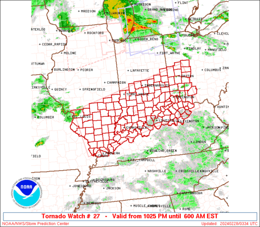
This system may go boom
Toot- La Vida Loca
- Posts : 6644
Join date : 2011-12-05
Location : Cocke County, TN -
Re: *FEBUARY 19th/20th 2012 SNOW THREAT*
![]() by Vanster67 2012-02-18, 7:30 am
by Vanster67 2012-02-18, 7:30 am


Vanster67- Admin
- Posts : 629
Join date : 2011-12-08
Age : 57
Location : Monterey, TN
Re: *FEBUARY 19th/20th 2012 SNOW THREAT*
![]() by Adam2014 2012-02-18, 7:33 am
by Adam2014 2012-02-18, 7:33 am

Adam2014- Founding Member
- Posts : 1424
Join date : 2011-12-05
Age : 28
Location : Lawrenceburg,TN
Re: *FEBUARY 19th/20th 2012 SNOW THREAT*
![]() by Tom 2012-02-18, 7:39 am
by Tom 2012-02-18, 7:39 am
Tom- Banned
- Posts : 86
Join date : 2012-01-06

Toot- La Vida Loca
- Posts : 6644
Join date : 2011-12-05
Location : Cocke County, TN -
Page 20 of 39 • 1 ... 11 ... 19, 20, 21 ... 29 ... 39 ![]()
» Feb 13th/14th 2012 Snow/ice Threat
» Early FEB snow threat
» Jan 13-15 Arctic Boundary Ice/Sleet/Snow/Flooding threat
» Call Map Thread for February 19th Storm


