


Valentines Day snow
Page 6 of 8 •  1, 2, 3, 4, 5, 6, 7, 8
 ![]()
Re: Valentines Day snow
![]() by Toot 2013-02-08, 5:08 pm
by Toot 2013-02-08, 5:08 pm

Toot- La Vida Loca
- Posts : 6644
Join date : 2011-12-05
Location : Cocke County, TN -


John1122- Winter Specialist
- Posts : 885
Join date : 2011-12-06
Location : Campbell Co
Re: Valentines Day snow
![]() by Toot 2013-02-08, 5:46 pm
by Toot 2013-02-08, 5:46 pm
Toot- La Vida Loca
- Posts : 6644
Join date : 2011-12-05
Location : Cocke County, TN -
Re: Valentines Day snow
![]() by weathertree4u 2013-02-08, 7:54 pm
by weathertree4u 2013-02-08, 7:54 pm
Toot wrote:I think Nashville may end up being the sweet spot with this winter storm. They deserve one!! I still think most places in Tennessee will likely see some accumulating snow of course the ripoff zone may be southeast TN again. I know you guys are getting tired of that
Can you give me more detail on that? Being just north of Nashville, I can attest to the fact that it has been many years since we have had enough snow to plow
weathertree4u- Member
- Posts : 14
Join date : 2013-02-08
Age : 53
Location : Cottontown TN
Re: Valentines Day snow
![]() by Toot 2013-02-08, 8:12 pm
by Toot 2013-02-08, 8:12 pm
weathertree4u wrote:
Can you give me more detail on that? Being just north of Nashville, I can attest to the fact that it has been many years since we have had enough snow to plow
Welcome to the forum!
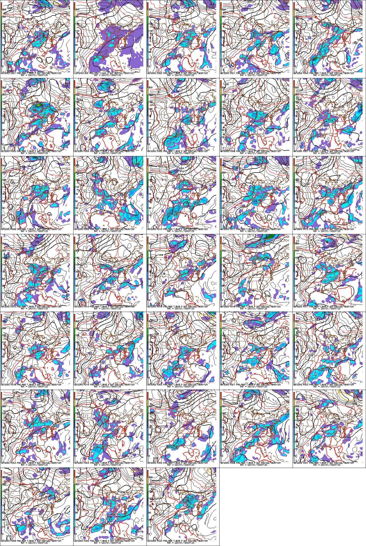
I was speaking in terms of unelevated areas in Tennessee. As it sits right now with the guidance consensus the GFS suite/CMC suite..the track would favor Nashville being in that "Sweet Spot" where temp profiles and moisture are just right for moderate to heavy synoptic snow!
This whole thing seems to be trending stronger tho..the ensembles are just getting too sexy to look at and have trended slightly east. I have quite the suspicion that this is going to trend into a classic Miller A where most of the state does nicely..even Chatanooga. But guidance isnt quite there yet but damn..its getting close!

Seriously!! This is starting to take on that "Classic" Tenneseee snow storm look!
Toot- La Vida Loca
- Posts : 6644
Join date : 2011-12-05
Location : Cocke County, TN -
Re: Valentines Day snow
![]() by Jscentraltn 2013-02-08, 8:30 pm
by Jscentraltn 2013-02-08, 8:30 pm


Jscentraltn- Admin
- Posts : 703
Join date : 2013-01-19
Age : 45
Location : Cheatham county
Re: Valentines Day snow
![]() by Jscentraltn 2013-02-08, 8:32 pm
by Jscentraltn 2013-02-08, 8:32 pm
Jscentraltn- Admin
- Posts : 703
Join date : 2013-01-19
Age : 45
Location : Cheatham county
Re: Valentines Day snow
![]() by ballpark 2013-02-08, 10:17 pm
by ballpark 2013-02-08, 10:17 pm
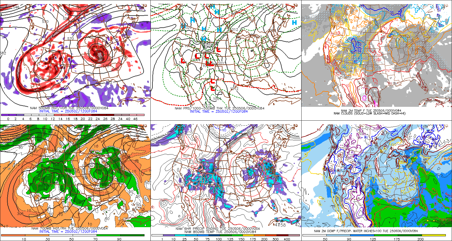
stream system on Wednesday. The 08/12Z GFS has been quite
aggressive the past run or two with bringing a deformation band of
rain/snow into southern KY. In fact, taken at face value, the
08/12Z GFS would give several inches of a heavy, wet snow to
southern KY. The bad news for all you snow lovers is that the ECMWF
has been very consistent in its solution of keeping all the
precipitation south. Therefore, will lean toward the consistent
ECMWF and continue with a dry forecast. However, this system will
need to be watched in the coming days as the operational GFS now is
gaining some support from some of its 08/12Z ensemble members.
Otherwise, the Wednesday system quickly pushes east, allowing for
dry conditions to work back in for Thursday. After highs in the 40s
on Wednesday, temperatures will rebound into the upper 40s and lower
50s on Thursday.
ballpark- Banned
- Posts : 155
Join date : 2011-12-07
Location : White House -
Re: Valentines Day snow
![]() by Toot 2013-02-08, 10:31 pm
by Toot 2013-02-08, 10:31 pm

Its been all over the map with this system..and it is out to still out to lunch right now! I would put big money down that it will come back in line with the GFS. The GFS has MAJOR ensemble support.
Toot- La Vida Loca
- Posts : 6644
Join date : 2011-12-05
Location : Cocke County, TN -
Re: Valentines Day snow
![]() by Toot 2013-02-08, 10:56 pm
by Toot 2013-02-08, 10:56 pm

Toot- La Vida Loca
- Posts : 6644
Join date : 2011-12-05
Location : Cocke County, TN -
ballpark- Banned
- Posts : 155
Join date : 2011-12-07
Location : White House -
Re: Valentines Day snow
![]() by Jscentraltn 2013-02-08, 11:46 pm
by Jscentraltn 2013-02-08, 11:46 pm

Jscentraltn- Admin
- Posts : 703
Join date : 2013-01-19
Age : 45
Location : Cheatham county
Re: Valentines Day snow
![]() by Toot 2013-02-08, 11:50 pm
by Toot 2013-02-08, 11:50 pm
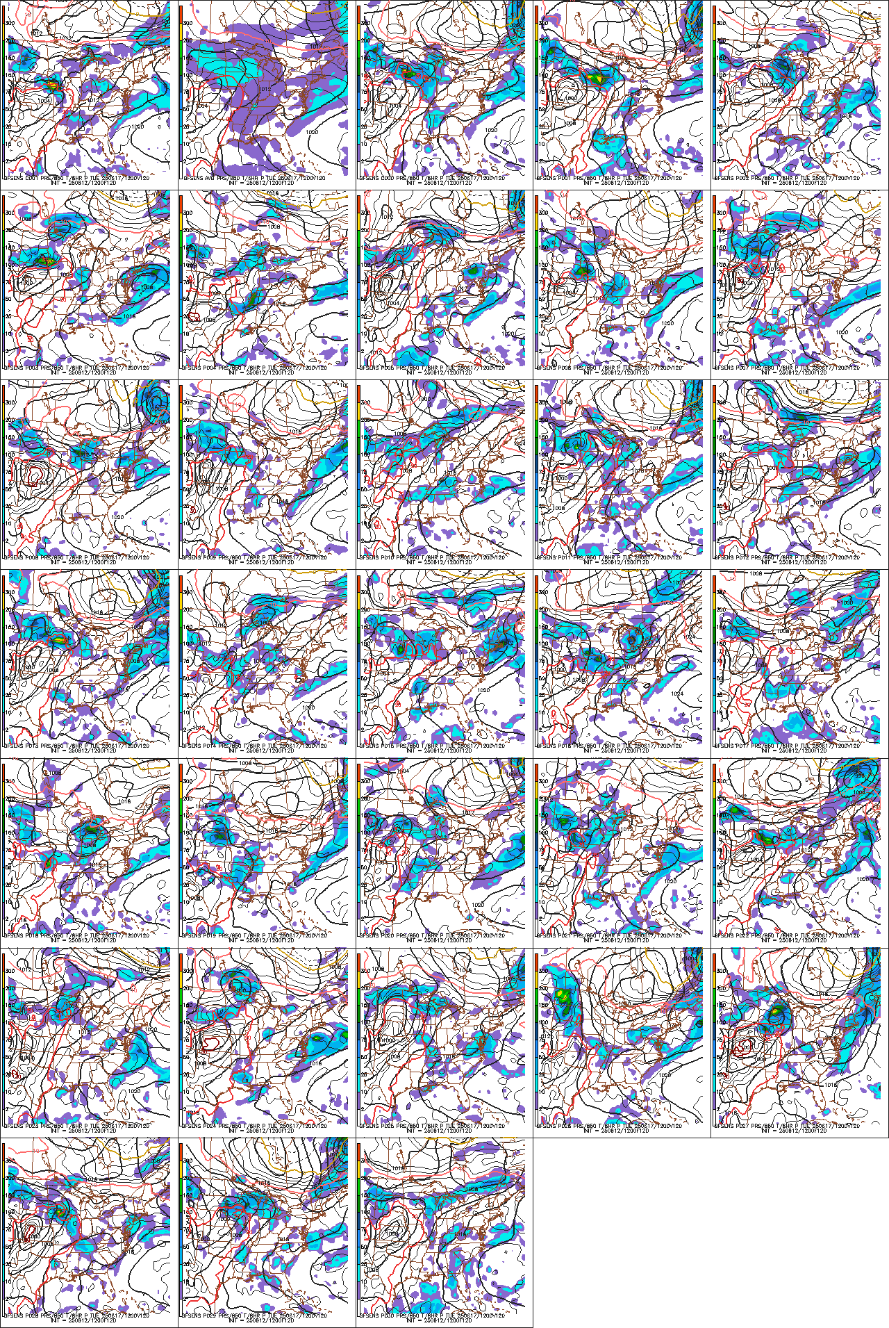
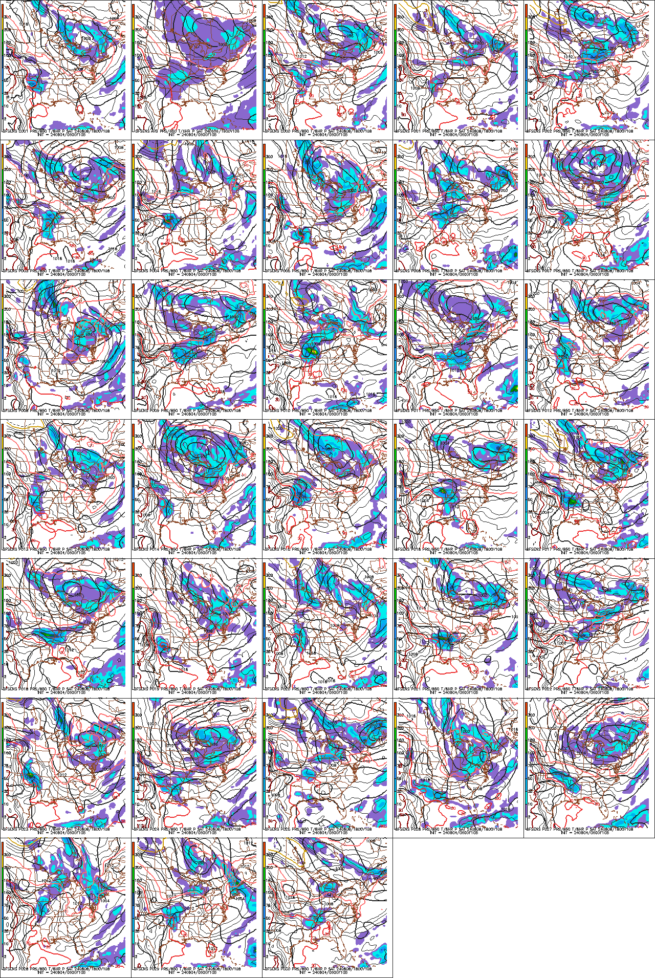
Notice the swath of accumulating snow has basically covered the whole state now

Toot- La Vida Loca
- Posts : 6644
Join date : 2011-12-05
Location : Cocke County, TN -
Re: Valentines Day snow
![]() by Jscentraltn 2013-02-08, 11:56 pm
by Jscentraltn 2013-02-08, 11:56 pm
Jscentraltn- Admin
- Posts : 703
Join date : 2013-01-19
Age : 45
Location : Cheatham county
Re: Valentines Day snow
![]() by John1122 2013-02-09, 12:34 am
by John1122 2013-02-09, 12:34 am
John1122- Winter Specialist
- Posts : 885
Join date : 2011-12-06
Location : Campbell Co
Re: Valentines Day snow
![]() by Toot 2013-02-09, 1:00 am
by Toot 2013-02-09, 1:00 am
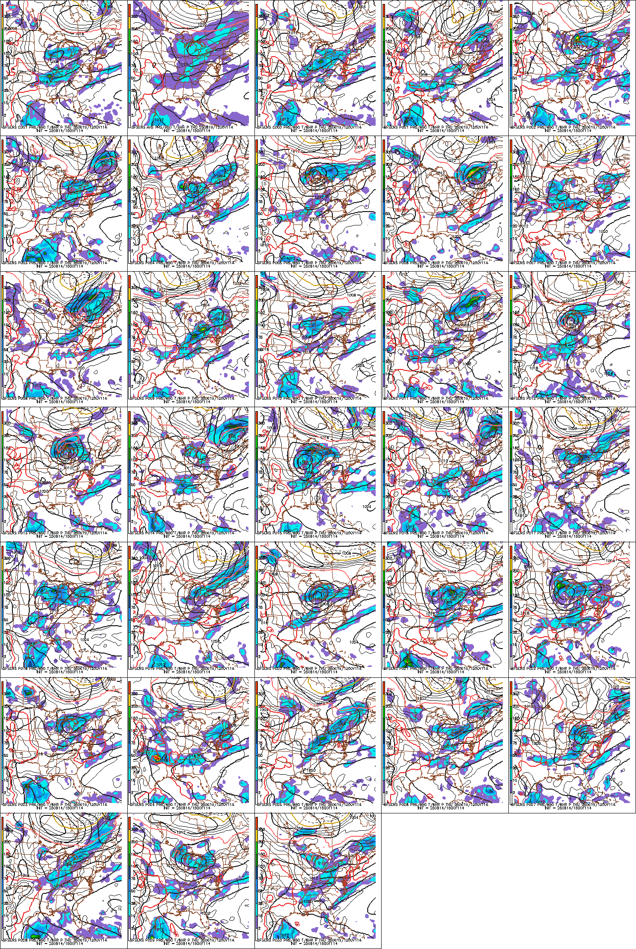
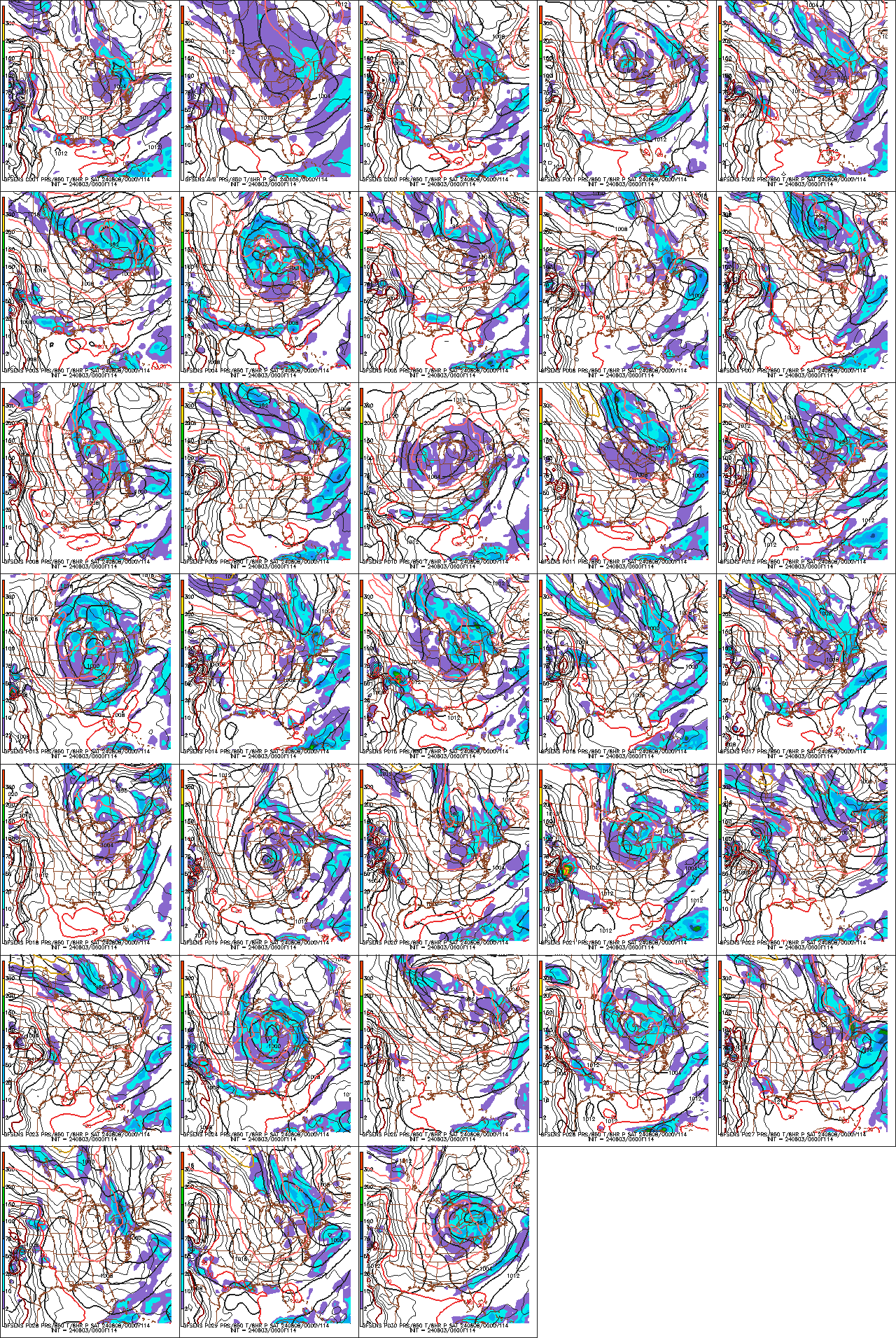
0z Canadian continues eastward trend

Toot- La Vida Loca
- Posts : 6644
Join date : 2011-12-05
Location : Cocke County, TN -
Re: Valentines Day snow
![]() by weathertree4u 2013-02-09, 6:16 am
by weathertree4u 2013-02-09, 6:16 am
John1122 wrote:This one still looks like 1-4 inches across a good portion of especially East Tennessee. The President's day storm is just a monster. It actually improved on 00z.
I agree with the one after the Valentine Day storm, that one is looking a little more than even I wanted, better be careful what you wish for I guess
weathertree4u- Member
- Posts : 14
Join date : 2013-02-08
Age : 53
Location : Cottontown TN
Re: Valentines Day snow
![]() by ballpark 2013-02-09, 8:04 am
by ballpark 2013-02-09, 8:04 am
ballpark- Banned
- Posts : 155
Join date : 2011-12-07
Location : White House -
Re: Valentines Day snow
![]() by weathertree4u 2013-02-09, 9:03 am
by weathertree4u 2013-02-09, 9:03 am
ballpark wrote:GFS 6Z run has snow on the Northern TN Counties. Still a lot of model jumping going on.
Yea, now to get the NWS on board
weathertree4u- Member
- Posts : 14
Join date : 2013-02-08
Age : 53
Location : Cottontown TN
Re: Valentines Day snow
![]() by Toot 2013-02-09, 10:19 am
by Toot 2013-02-09, 10:19 am
The big dog looks to be the storm after this one even tho this one aint no slouch its just not a big dog when compared to what is being progged after this one! I will take big dog out of the this thread title.
Toot- La Vida Loca
- Posts : 6644
Join date : 2011-12-05
Location : Cocke County, TN -
Re: Valentines Day snow
![]() by Toot 2013-02-09, 11:46 am
by Toot 2013-02-09, 11:46 am
This one is gonna catch people off guard due to the wall to wall media coverage of the Yankee Screamer blizzard...lol
Nobody is really mentioning this system which could have really widespread affects from teh Arlkatex on up into the NE!
Toot- La Vida Loca
- Posts : 6644
Join date : 2011-12-05
Location : Cocke County, TN -


Toot- La Vida Loca
- Posts : 6644
Join date : 2011-12-05
Location : Cocke County, TN -
Re: Valentines Day snow
![]() by tom23 2013-02-09, 4:58 pm
by tom23 2013-02-09, 4:58 pm
tom23- Founding Member
- Posts : 298
Join date : 2012-07-06
Age : 30
Location : Jefferson City, TN
Re: Valentines Day snow
![]() by Toot 2013-02-09, 5:08 pm
by Toot 2013-02-09, 5:08 pm
You need to go do some meteorology homework if you think that is cold air chasing precip..LOLtom23 wrote:That run of the Nam model looks like cold air chasing the precip
Toot- La Vida Loca
- Posts : 6644
Join date : 2011-12-05
Location : Cocke County, TN -
Re: Valentines Day snow
![]() by John1122 2013-02-09, 5:13 pm
by John1122 2013-02-09, 5:13 pm
The 18z GFS looks okay for this event. Sadly it's probably not going to have a strong P-day storm because the storm is heading ots instead of bombing in NE.
John1122- Winter Specialist
- Posts : 885
Join date : 2011-12-06
Location : Campbell Co
Page 6 of 8 • 1, 2, 3, 4, 5, 6, 7, 8 ![]()
» Early FEB snow threat
» Late season Mtn snow
» March 5-6th Winter Storm
» Accumulating Snow Possible Mar 24-26


