May Severe Weather
+16
Dyersburg Weather
chaser2b
John1122
BethD
Math/Met
WxFreak
Reb
Grandpa Nasty
Homemommy
andyhb
Vanster67
Matthew
Adam2014
Toot
Stovepipe
tennessee storm09
20 posters
Page 14 of 20
Page 14 of 20 •  1 ... 8 ... 13, 14, 15 ... 20
 Re: May Severe Weather
The structure of these storms is completely different that the MCS that came through this morning. They are all separated, and definitely have a "super cell" look to them.

WxFreak- Founding Member
- Posts : 812
Join date : 2012-03-27
Age : 52
Location : East Sevier County, TN
 Re: May Severe Weather
WxFreak wrote:The structure of these storms is completely different that the MCS that came through this morning. They are all separated, and definitely have a "super cell" look to them.
Yep..be interesting to see if they congeal into a line befor they get here...probably some big hailers with an isolated TOR threat either way


 Re: May Severe Weather
I could be wrong (and I often am), but I have my doubts these storms are going to maintain their strength as they move into East Tn. The reason being--we were cloudy all day, and we're cooler than expected. Meteorology 101 says a cloudy, cool day after the atmosphere has been worked over, should be less conducive for severe storms. If these storms had a more organized structure (like what we had this morning) , I'd be more inclined to think we'd all see some severe storms later in our neck of the woods. At the very least, I think any severe weather will be more isolated tonight compared to this morning.
Oh well, no one take this as gospel. Just a thought rattlin' around in my head.
Oh well, no one take this as gospel. Just a thought rattlin' around in my head.


WxFreak- Founding Member
- Posts : 812
Join date : 2012-03-27
Age : 52
Location : East Sevier County, TN
 Re: May Severe Weather
I hear the sound of chainsaws around the house tonight. Guess I'm not the only one with a mess to clean up after this morning.
Sad thing is: my chainsaw broke last year. Now I'm gonna have to go buy another one.
Sad thing is: my chainsaw broke last year. Now I'm gonna have to go buy another one.


WxFreak- Founding Member
- Posts : 812
Join date : 2012-03-27
Age : 52
Location : East Sevier County, TN
 Re: May Severe Weather
Looking at SPC Mesoscale Analysis... the great valley of east TN is pretty unstable and there is a decent amount of shear/helicity around. Normally I would agree with you freak but im not seeing much that should weaken these storms aside from the loss of daytime heating.
You could be right tho weve been socked in with clouds all day but it hasnt stableized the atmosphere very much to my eyes. I cant tell you why tho...its not a very dynamic system...maybe math met or somebody will weigh in.
You could be right tho weve been socked in with clouds all day but it hasnt stableized the atmosphere very much to my eyes. I cant tell you why tho...its not a very dynamic system...maybe math met or somebody will weigh in.
 Re: May Severe Weather
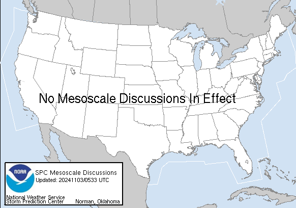
MESOSCALE DISCUSSION 0596
NWS STORM PREDICTION CENTER NORMAN OK
0540 PM CDT THU APR 26 2012
AREAS AFFECTED...SRN/SERN KY...MIDDLE/ERN TN...FAR WRN VA
CONCERNING...SEVERE THUNDERSTORM WATCH 191...
VALID 262240Z - 270015Z
THE SEVERE WEATHER THREAT FOR SEVERE THUNDERSTORM WATCH 191
CONTINUES.
AT 2230Z...REGIONAL RADAR IMAGERY SHOWS ONGOING SUPERCELLS MOVING
SEWD AT 25-35 KT ACROSS PORTIONS OF NRN MIDDLE TN INTO SERN KY.
SURFACE THERMODYNAMIC ENVIRONMENT ACROSS THE AREA IS CHARACTERIZED
BY TEMPERATURES IN THE UPR 60S TO LOW-MID 70S...AND DEWPOINTS IN THE
LOW TO MID 60S. IN ADDITION...OBJECTIVE ANALYSIS GUIDANCE SHOWS
MUCAPE VALUES RANGING FROM 1000-2000 J/KG ALONG AND AHEAD OF ONGOING
STORMS. GIVEN THE PRESENCE OF DYNAMIC FORCING FOR ASCENT ASSOCIATED
WITH MID OH VALLEY UPR DISTURBANCE...AS WELL AS LOW-LEVEL FRONTAL
FORCING...STORMS MAY PERSIST AS THEY MOVE SEWD OUT OF CURRENT
SPATIAL BOUNDS OF WW 191. AREA VWP/S INDICATE SHEAR WILL REMAIN
SUFFICIENT FOR CONTINUED STORM ORGANIZATION /INCLUDING SUPERCELLS/.
THUS...THREAT FOR LARGE HAIL AND DAMAGING WINDS MAY SPREAD INTO THE
REMAINDER OF MIDDLE/ERN TN AND POSSIBLY FAR WRN VA...WHICH COULD
RESULT IN THE NEED FOR EITHER A NEW WW...OR A SPATIAL EXPANSION OF
WW 191 BY LOCAL WFO/S.
 Re: May Severe Weather
There are three separate cells dropping south into TN. All are warned. The most impressive one is heading into Bell Co, KY (Middlesboro). It's tornado warned. That poor town has had it rough lately. They had a major flooding event last year during the summer. Then were rocked hard during this year's severe weather outbreak. It seems the town has a bulls-eye painted on it for severe weather lately.
Last edited by WxFreak on 2012-04-26, 7:01 pm; edited 1 time in total

WxFreak- Founding Member
- Posts : 812
Join date : 2012-03-27
Age : 52
Location : East Sevier County, TN
 Re: May Severe Weather
The way these storms are structured, some areas could get hit hard, and others will "thread the needle" between them, and may see little at all.
The storm cell in the middle of the other two (near Jellico) seems to be weakening a bit. The warning was also temporarily dropped.
The storm cell in the middle of the other two (near Jellico) seems to be weakening a bit. The warning was also temporarily dropped.

WxFreak- Founding Member
- Posts : 812
Join date : 2012-03-27
Age : 52
Location : East Sevier County, TN
 Re: May Severe Weather
Really only two cells of interest that are still warned and heading toward the Great Valley. But the one heading toward Knoxville now has a tornado warning:
It's still far off to the northwest, but moving southeast toward Knox Co.
EDIT: The other storm moving out of Bell Co. Ky into TN has weakened, and the TOR warning has been dropped. Just by looking at the radar, it appears these cells are struggling.
BULLETIN - EAS ACTIVATION REQUESTED
TORNADO WARNING
NATIONAL WEATHER SERVICE MORRISTOWN TN
709 PM EDT THU APR 26 2012
THE NATIONAL WEATHER SERVICE IN MORRISTOWN HAS ISSUED A
* TORNADO WARNING FOR...
SCOTT COUNTY IN EAST TENNESSEE...
* UNTIL 745 PM EDT
* AT 703 PM EDT...NATIONAL WEATHER SERVICE DOPPLER RADAR INDICATED A
SEVERE THUNDERSTORM CAPABLE OF PRODUCING A TORNADO 6 MILES
SOUTHWEST OF ONEIDA. DOPPLER RADAR SHOWED THIS TORNADO MOVING
SOUTHEAST AT 30 MPH.
* LOCATIONS IN THE WARNING INCLUDE...
HUNTSVILLE...SLICK ROCK...NORMA AND SMOKEY JUNCTION.
PRECAUTIONARY/PREPAREDNESS ACTIONS...
IN ADDITION TO THE TORNADO...THIS STORM IS CAPABLE OF PRODUCING
GOLF BALL SIZED HAIL AND DESTRUCTIVE STRAIGHT LINE WINDS.
It's still far off to the northwest, but moving southeast toward Knox Co.
EDIT: The other storm moving out of Bell Co. Ky into TN has weakened, and the TOR warning has been dropped. Just by looking at the radar, it appears these cells are struggling.

WxFreak- Founding Member
- Posts : 812
Join date : 2012-03-27
Age : 52
Location : East Sevier County, TN
 Re: May Severe Weather
Excellent weather commentary WxFreak, really appreciate that bud. Just wanted you to know!


 Re: May Severe Weather
Thanks bro. Just keepin' it real. lol


WxFreak- Founding Member
- Posts : 812
Join date : 2012-03-27
Age : 52
Location : East Sevier County, TN
 Re: May Severe Weather
Storm in Scott Co. holding it's own (but the true test will happen when it comes down off the Plateau). The others have really weakened. But I see a few new cells trying to form just east of Morristown. Nothing severe at the moment.
Right now, the storm heading toward Anderson and Knox Co seems to be only game left in town for East TN. And while it remains warned for severe, the TOR warning has been dropped.
Right now, the storm heading toward Anderson and Knox Co seems to be only game left in town for East TN.
 And while it remains warned for severe, the TOR warning has been dropped.
 BULLETIN - IMMEDIATE BROADCAST REQUESTED
SEVERE THUNDERSTORM WARNING
NATIONAL WEATHER SERVICE MORRISTOWN TN
731 PM EDT THU APR 26 2012
THE NATIONAL WEATHER SERVICE IN MORRISTOWN HAS ISSUED A
* SEVERE THUNDERSTORM WARNING FOR...
ANDERSON COUNTY IN EAST TENNESSEE...
CAMPBELL COUNTY IN EAST TENNESSEE...
SCOTT COUNTY IN EAST TENNESSEE...
* UNTIL 815 PM EDT
* AT 726 PM EDT...NATIONAL WEATHER SERVICE DOPPLER RADAR INDICATED A
SEVERE THUNDERSTORM CAPABLE OF PRODUCING QUARTER SIZE HAIL...AND
DAMAGING WINDS IN EXCESS OF 60 MPH. THIS STORM WAS LOCATED NEAR
ONEIDA...AND MOVING SOUTHEAST AT 30 MPH.
* LOCATIONS IN THE WARNING INCLUDE...
ONEIDA...LA FOLLETTE...HUNTSVILLE...JACKSBORO...WINFIELD...NORMA...
ELK VALLEY...SMOKEY JUNCTION...ROYAL BLUE AND CARYVILLE.

WxFreak- Founding Member
- Posts : 812
Join date : 2012-03-27
Age : 52
Location : East Sevier County, TN
 Re: May Severe Weather
Radar is fairly exciting for TN right now. Better than anything we've seen in recent days aside from maybe this morning. I'll take it!
 Re: May Severe Weather
Well guys & gals, all warnings have expired and/or been cancelled. It appears our cloudy day played havoc with our storms tonight, especially considering how worked over our atmosphere was by this morning's storms. Maybe we'll have a few pop up as the front comes through overnight, as it is still up in southern KY, and a few storms have refired up there. You never know... 
Now, I just gotta start cutting up this tree at some point. Looks like I'll soon have my own debris pile to burn.

Now, I just gotta start cutting up this tree at some point. Looks like I'll soon have my own debris pile to burn.


WxFreak- Founding Member
- Posts : 812
Join date : 2012-03-27
Age : 52
Location : East Sevier County, TN
 Re: May Severe Weather
Stovepipe wrote:Radar is fairly exciting for TN right now. Better than anything we've seen in recent days aside from maybe this morning. I'll take it!
The remains of the earlier severe storm is still there north of Knox Co. Something may try to reform there along the outflow boundry left by that storm.

WxFreak- Founding Member
- Posts : 812
Join date : 2012-03-27
Age : 52
Location : East Sevier County, TN
 Re: May Severe Weather
Toot wrote:Freak for president..lol
LOL...they couldn't pay me enough.


WxFreak- Founding Member
- Posts : 812
Join date : 2012-03-27
Age : 52
Location : East Sevier County, TN
 Re: May Severe Weather
One interesting note...storms continue to fire to our SOUTH--further away from the frontal boundry. The storms in southeast TN, and southwest NC seem to be firing along the left over outflow boundry from this morning's convection. Sometimes these small scale boundries are more potent than the actual cold front.
Last edited by WxFreak on 2012-04-26, 9:15 pm; edited 1 time in total

WxFreak- Founding Member
- Posts : 812
Join date : 2012-03-27
Age : 52
Location : East Sevier County, TN
 Re: May Severe Weather
There was a tornado touchdown in franklin,TN. Lawrenceburg has been spared again for the time being. We had a lot of anvil debris that choked the storms of instability. Storms have indeed fired away from the frontal boundry which is incredible to see. Like WxFreak said they are firing around the old outflow boundry.

Adam2014- Founding Member
- Posts : 1424
Join date : 2011-12-05
Age : 28
Location : Lawrenceburg,TN
 Re: May Severe Weather
Yep...we got stuck between that boundry, and the front to our north. Maybe if the sun had been out all day, the atmosphere could have reloaded for another round. But you can't fire a gun without ammunition, and mother nature gave us a fistful of blanks today. 


WxFreak- Founding Member
- Posts : 812
Join date : 2012-03-27
Age : 52
Location : East Sevier County, TN
 Re: May Severe Weather
Except around the Nashville area of course, they had some shear going there for a little while. But the storms outflow boundries began to run into each other, there was not enough low-level shear to keep them from combining. Also we were losing instability as the sun went down so the storms have shriveled.WxFreak wrote:Yep...we got stuck between that boundry, and the front to our north. Maybe if the sun had been out all day, the atmosphere could have reloaded for another round. But you can't fire a gun without ammunition, and mother nature gave us a fistful of blanks today.

Adam2014- Founding Member
- Posts : 1424
Join date : 2011-12-05
Age : 28
Location : Lawrenceburg,TN
 Re: May Severe Weather
Adam2014 wrote: Except around the Nashville area of course, they had some shear going there for a little while. But the storms outflow boundries began to run into each other, there was not enough low-level shear to keep them from combining. Also we were losing instability as the sun went down so the storms have shriveled.
Areas further west toward Nashvegas weren't quite as worked over by this morning's convection. Not quite as much stable air left behind to overcome, I think.

WxFreak- Founding Member
- Posts : 812
Join date : 2012-03-27
Age : 52
Location : East Sevier County, TN
 Re: May Severe Weather
WxFreak wrote:Adam2014 wrote: Except around the Nashville area of course, they had some shear going there for a little while. But the storms outflow boundries began to run into each other, there was not enough low-level shear to keep them from combining. Also we were losing instability as the sun went down so the storms have shriveled.
And areas further west toward Nashvegas weren't quite as worked over by this morning's convection. Not quite as much stable air left behind to overcome, I think.

WxFreak- Founding Member
- Posts : 812
Join date : 2012-03-27
Age : 52
Location : East Sevier County, TN
 Re: May Severe Weather
Nope the MCS missed them this morning.

Adam2014- Founding Member
- Posts : 1424
Join date : 2011-12-05
Age : 28
Location : Lawrenceburg,TN
 Re: May Severe Weather
Well, the front is still going to be hanging around for several more days--going back and forth over the area. Still a chance for more interesting weather. Hope it just stays away from a certain campground in the Smokies. 


WxFreak- Founding Member
- Posts : 812
Join date : 2012-03-27
Age : 52
Location : East Sevier County, TN
Page 14 of 20 •  1 ... 8 ... 13, 14, 15 ... 20
 Similar topics
» Oct. 17/18 Severe Weather Thread
» June 3rd/4th severe weather possibilities.
» TODAY (MARCH 31) SEVERE WEATHER....
» Fall Severe Weather Thread
» severe weather december 10th 11th
» June 3rd/4th severe weather possibilities.
» TODAY (MARCH 31) SEVERE WEATHER....
» Fall Severe Weather Thread
» severe weather december 10th 11th
Page 14 of 20
Permissions in this forum:
You cannot reply to topics in this forum

